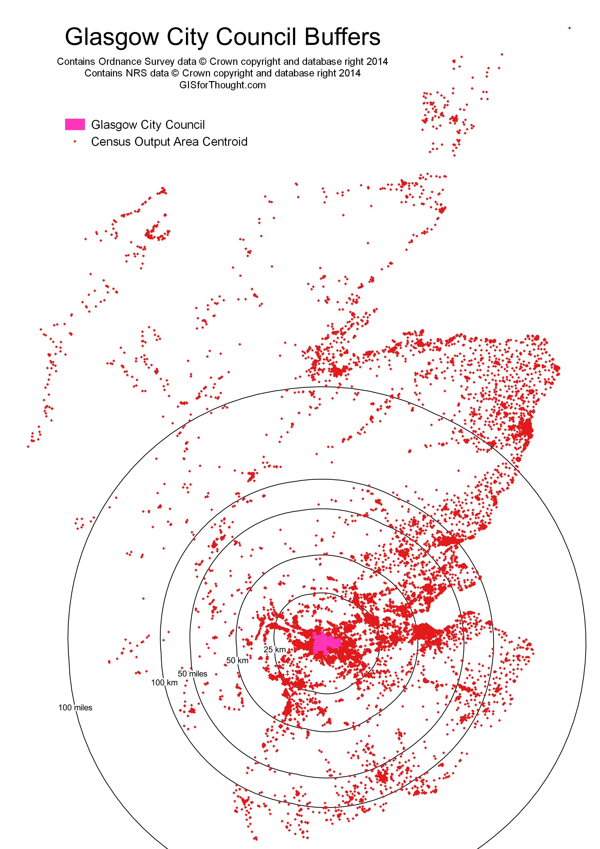
I have often heard that X percent of the population Scotland live within Y miles of Glasgow. With the X and the Y varying between claimant.
This is a pretty easy question to answer, using the 2011 Scottish Census population results and the Census Output Area Population Weighted Centroids. Then we get the extents of Glasgow City Council from OS Boundary Line.
The results are:
Pop. Count: | % | |
---|---|---|
Scotland | 5295403 | 100 |
Glasgow | 593245 | 11.2 |
25 km | 2002431 | 37.8 |
50 km | 2839583 | 53.6 |
50 miles | 3776701 | 71.3 |
100 km | 4201860 | 79.3 |
100 miles | 4483330 | 84.7 |
Pretty interesting results, especially the within 50 miles query.
To see how these boundaries look on a map:
A few caveats:
We are using the population weighted centroids, which will produce some minor inaccuracies, but is a very good generalisation.
Also we are using euclidean buffers on the British National Grid plain, so these are not geodesic buffers. The difference will likely be small at these distances.
as posted on the reddit r/scotland thread… shifted the 50mi circle to center on edinburgh – http://i.imgur.com/gMAKQOc.gif – that’s got to be even a higher percentage
hey – been waiting to see if you would recalc this centered on Edinburgh – i’m betting it’s closer to 75% – yes, you drop Ayr but also large sparsely populated areas on the west, add Dundee and more densely populated areas in the east
Can do, will probably be next week though.
Please see: http://gisforthought.com/x-percent-of-the-population-of-scotland-lives-within-y-miles-of-edinburgh/
Pingback: Mapvember 2014 | GIS for Thought
Pingback: X Percent of the Population of Scotland Lives Within Y Miles of Edinburgh | GIS for Thought