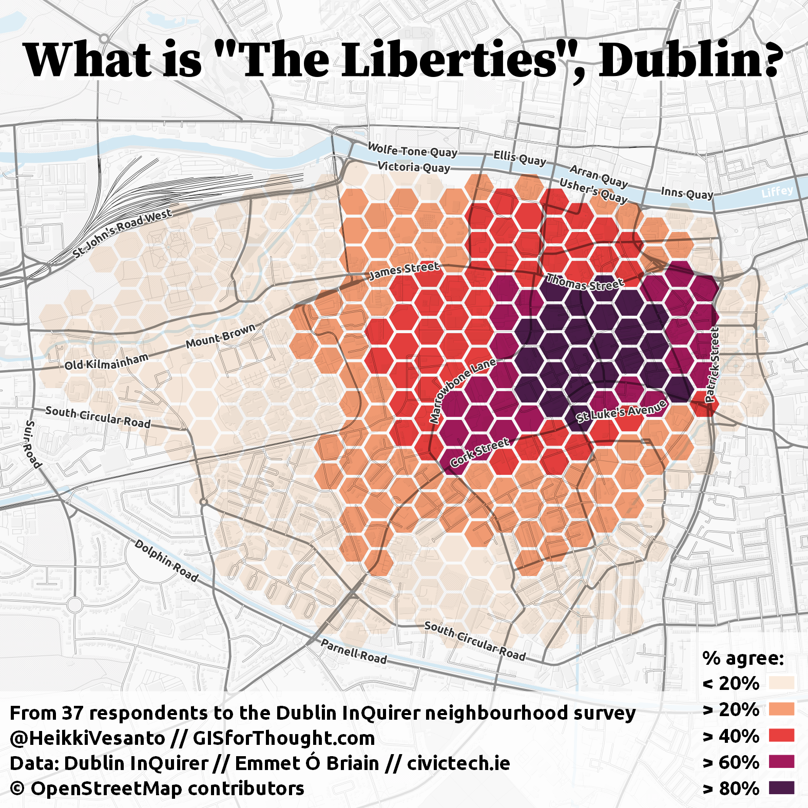
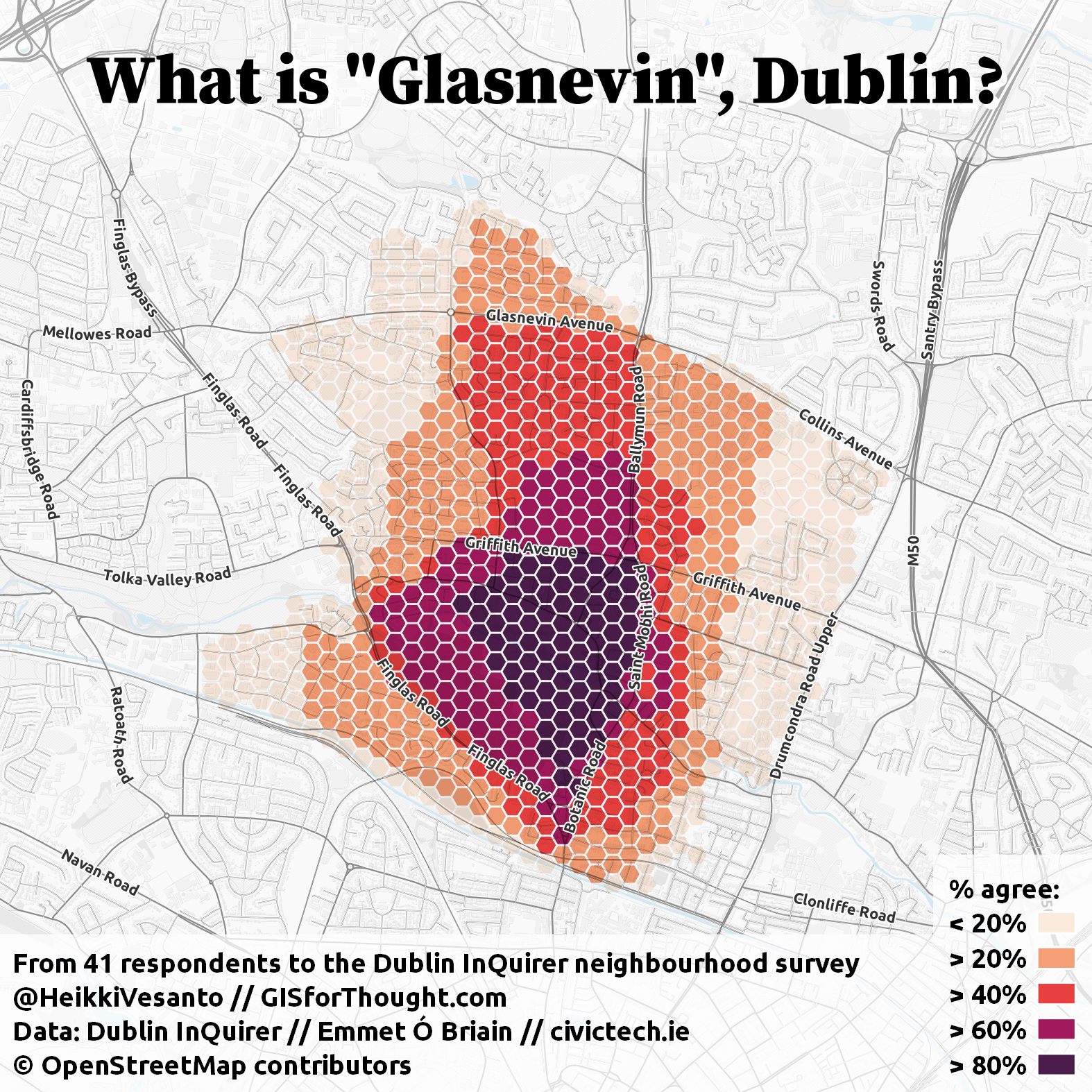
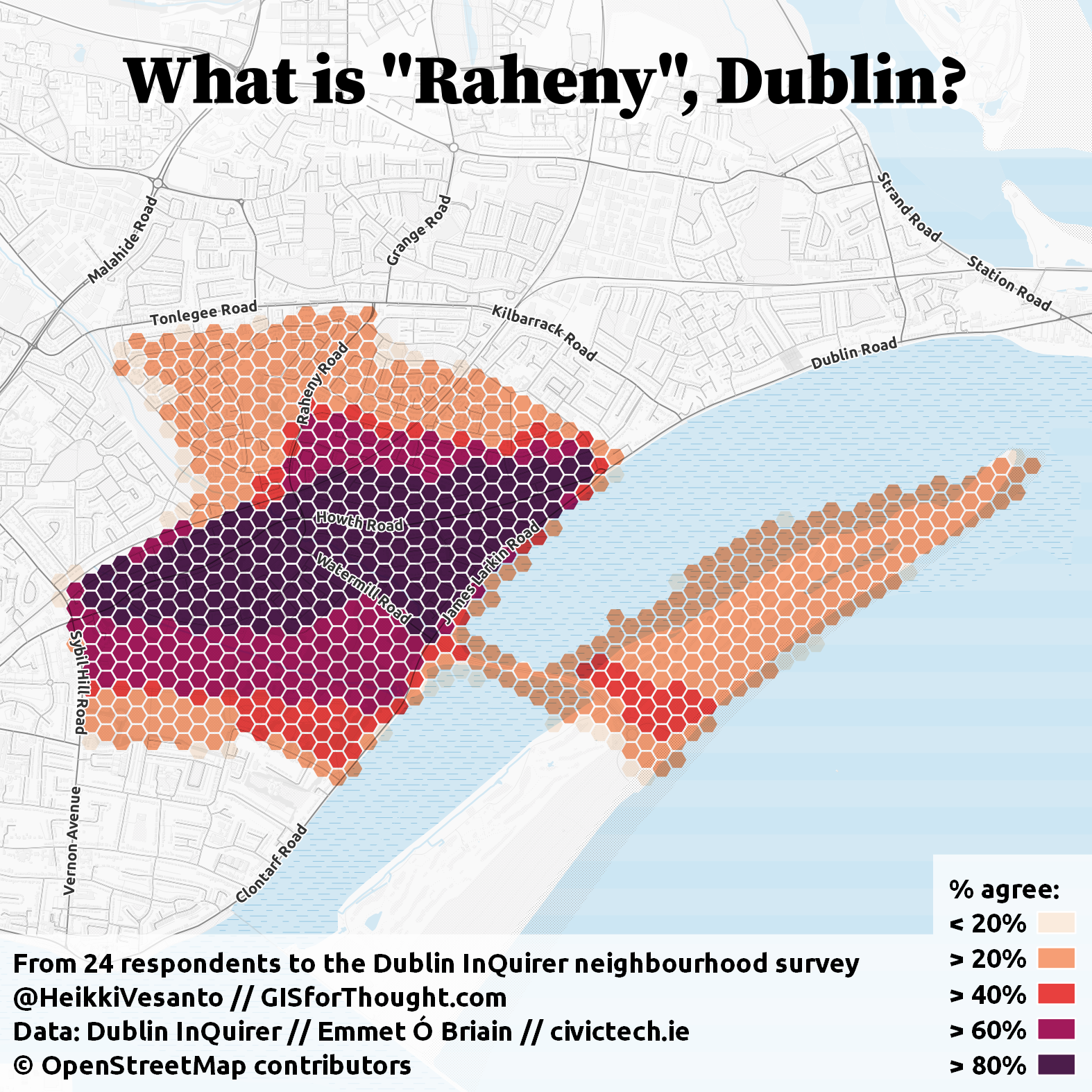
Mapping Dublin neighborhoods.
Based on a survey conducted by the Dulbin InQuirer. Data downloaded with a Python script and processed in PostgreSQL/PostGIS. Maps created in QGIS.
Individual neighborhood examples:
Interactive map:
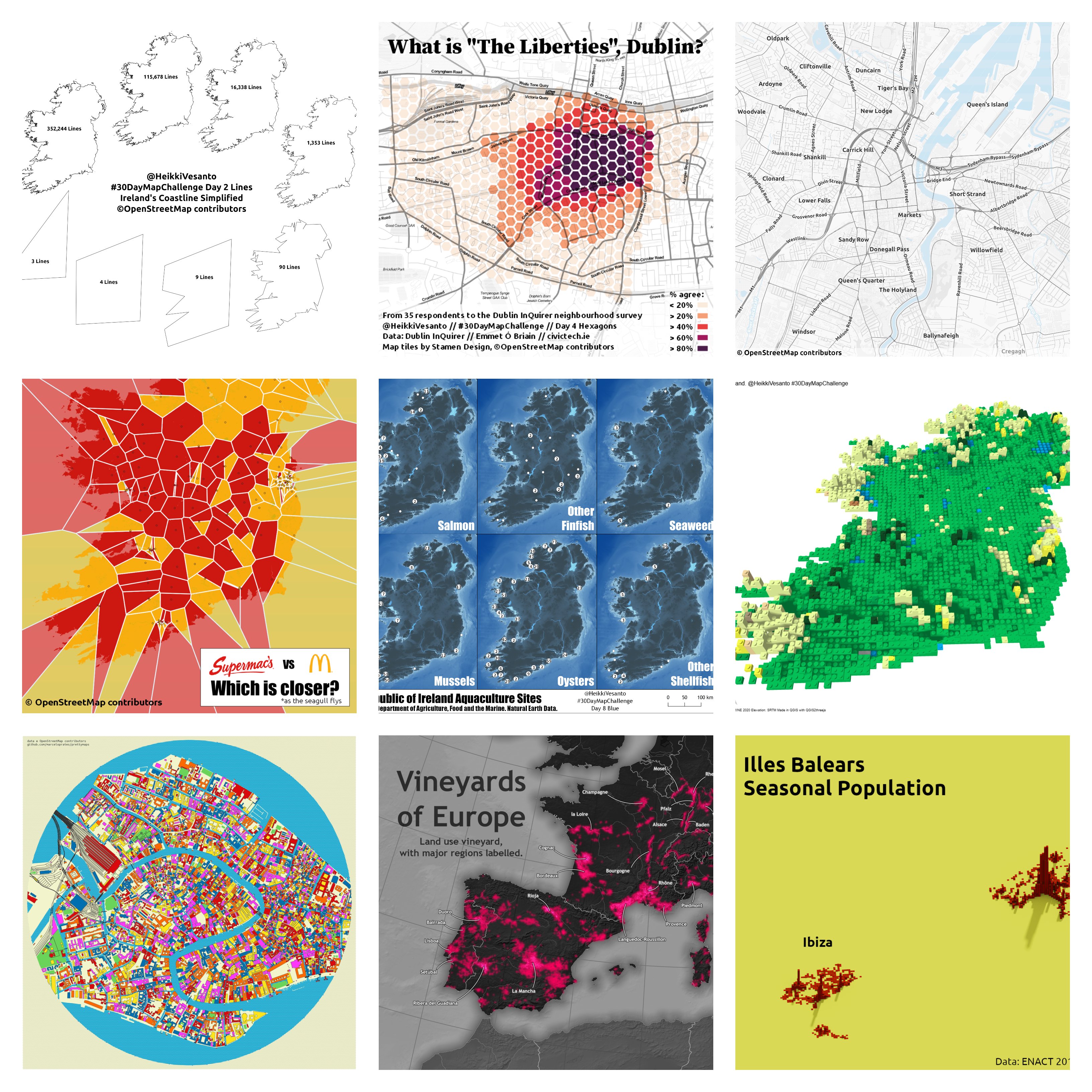
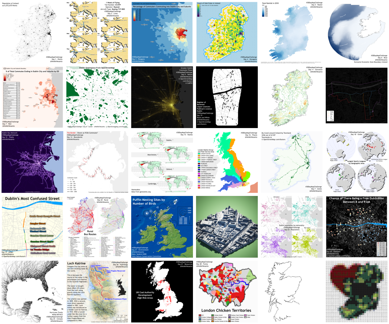
30 Day Mapping Challenge 2021
Mapping challenge to create a map every day in November.
Ireland 2020 General Election HEX Maps
Creating a HEX map for Irish general election results.
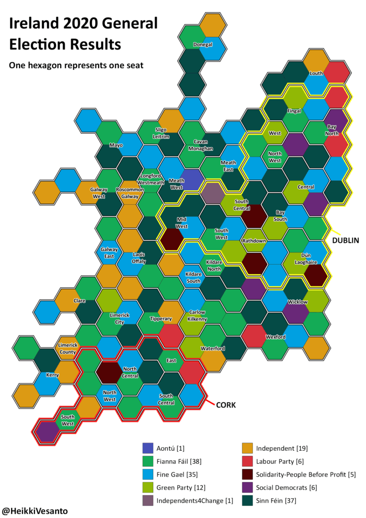
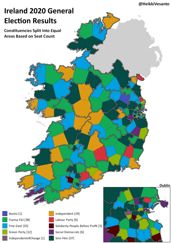
The hexes and split files can be found on GitHub.
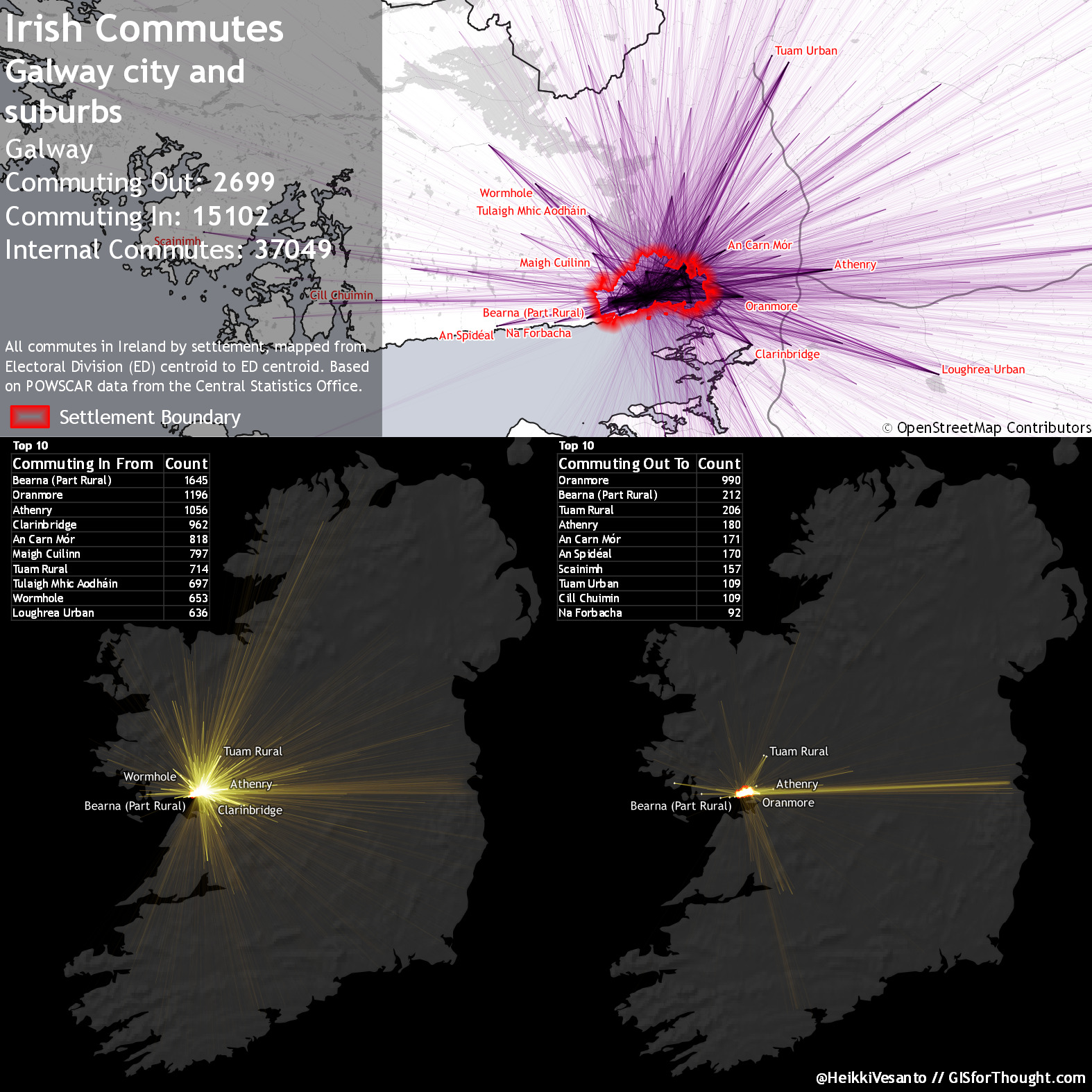
Mapping Irish Commutes
Mapping commuting in Ireland. Presented at the FOSS4GUK 2019 conference in Edinburgh, and featured in the 2020 GeoHipster calendar. Processing done in PostgreSQL/PostGIS and rendering in QGIS.
Done on a national scale:
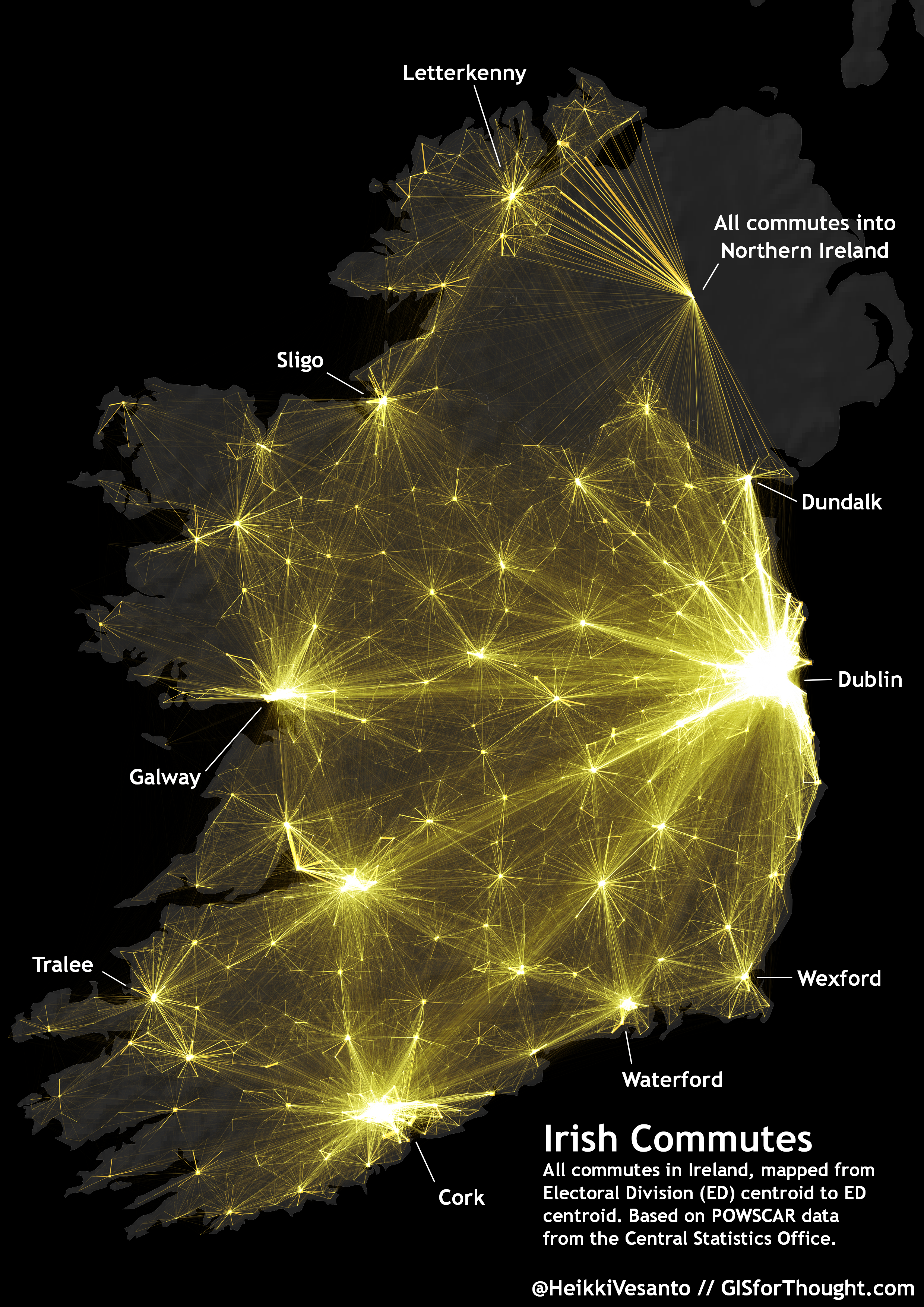
And individual settlements:
30 Day Mapping Challenge 2019
Mapping challenge to create a map every day in November.
Every Person in Great Britain Mapped
A follow up to the Scotland map. A point on the map for every person in Great Britain.
Generated using PostgreSQL/PostGIS, QGIS, with the web map in Leaflet JS.
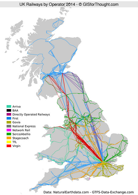
UK Rail Map
Mapping the UK Rail network by agency and parent company. Collects data directly from the GTFS feed, automatically processes it every month using python and SQL, resulting in an up to date view of the UK rail network.
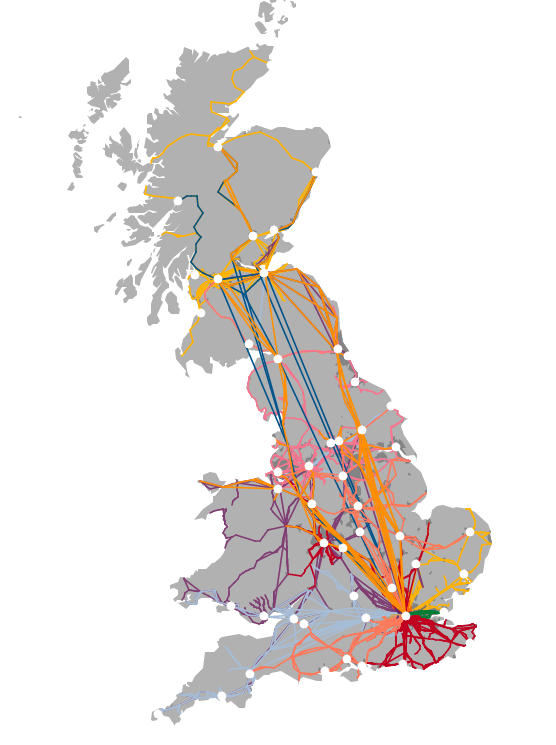
Full page interactive map.
Read more.
Every Person in Scotland Mapped
Winner of the 2016 OS OpenData Award for Excellence in the use of OpenData from the British Cartographic Society.
A point created for each person in Scotland, the points are placed inside of buildings that appear in postcodes. The count of points is determined by the population in each postcode.
Generated using PostgreSQL/PostGIS, QGIS, with the web map in Leaflet JS.
QGIS Multi Ring Buffer Plugin
Plugin to automate the creation of multiple buffer rings around a selection. Written in Python. Over 7000 downloads.
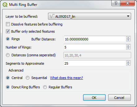
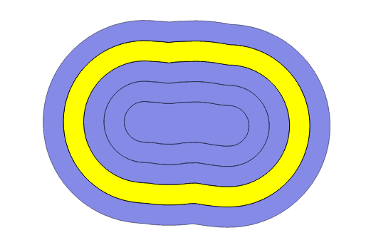
QGIS Plugin Repository.
GitHub.
Read more.
QGIS Centroid Within Selection Plugin
Plugin for QGIS to make centroid within and point on surface within selections. Written in Python. Over 2500 downloads.
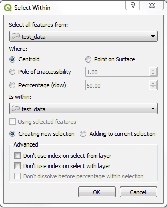

QGIS Plugin Repository.
GitHub.
Read more.
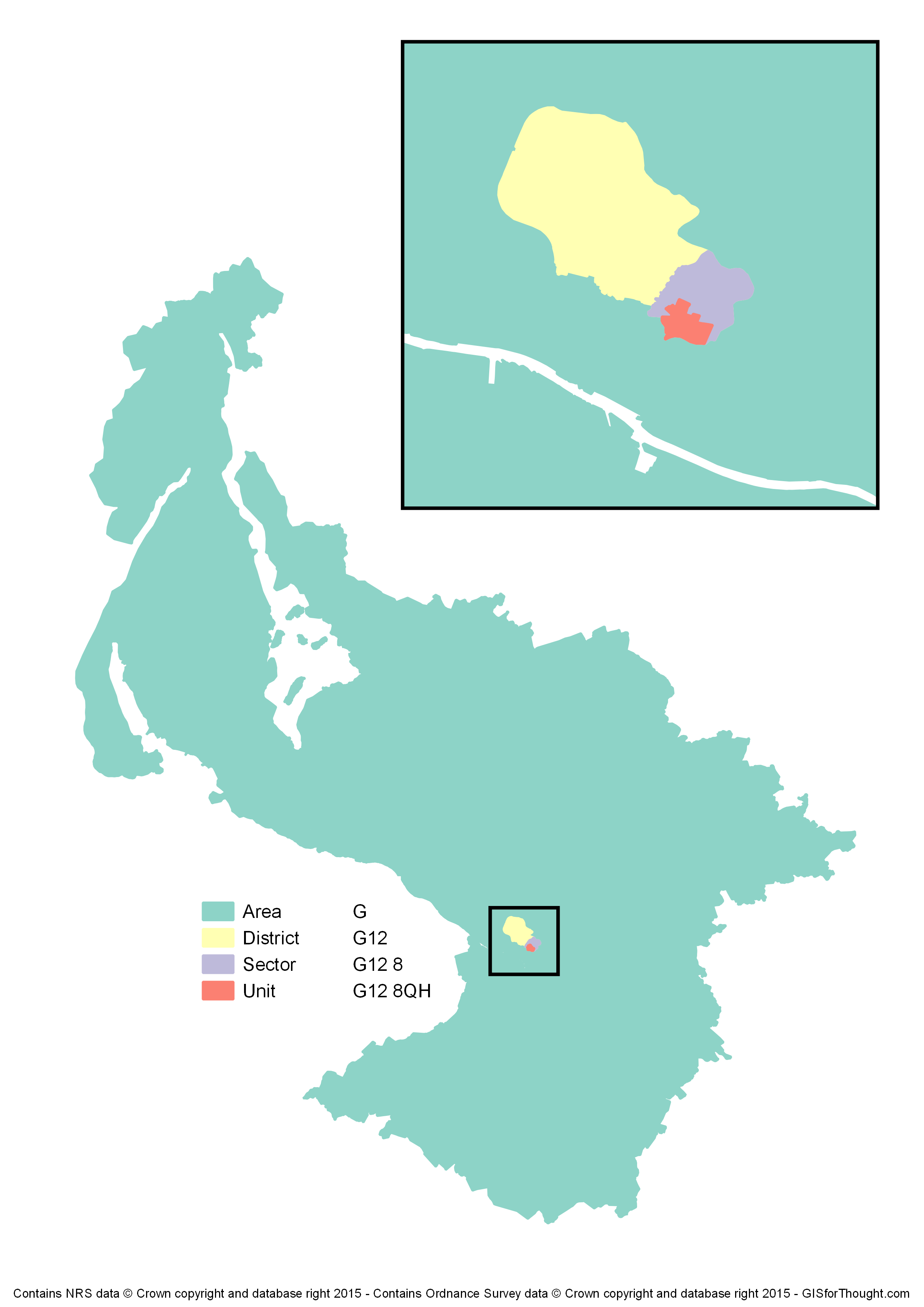
UK Postcode Comparison
Accuracy comparison of UK postcode data generated from Ordnance Survey CodePoint Open. Postcode areas generated from centroids using voronoi polygons.
Open data generated postcodes were compared against postcode data released by the National Records for Scotland. Comparison done for actual area, and at a property level using the Glasgow Corporate Address Gazetteer.

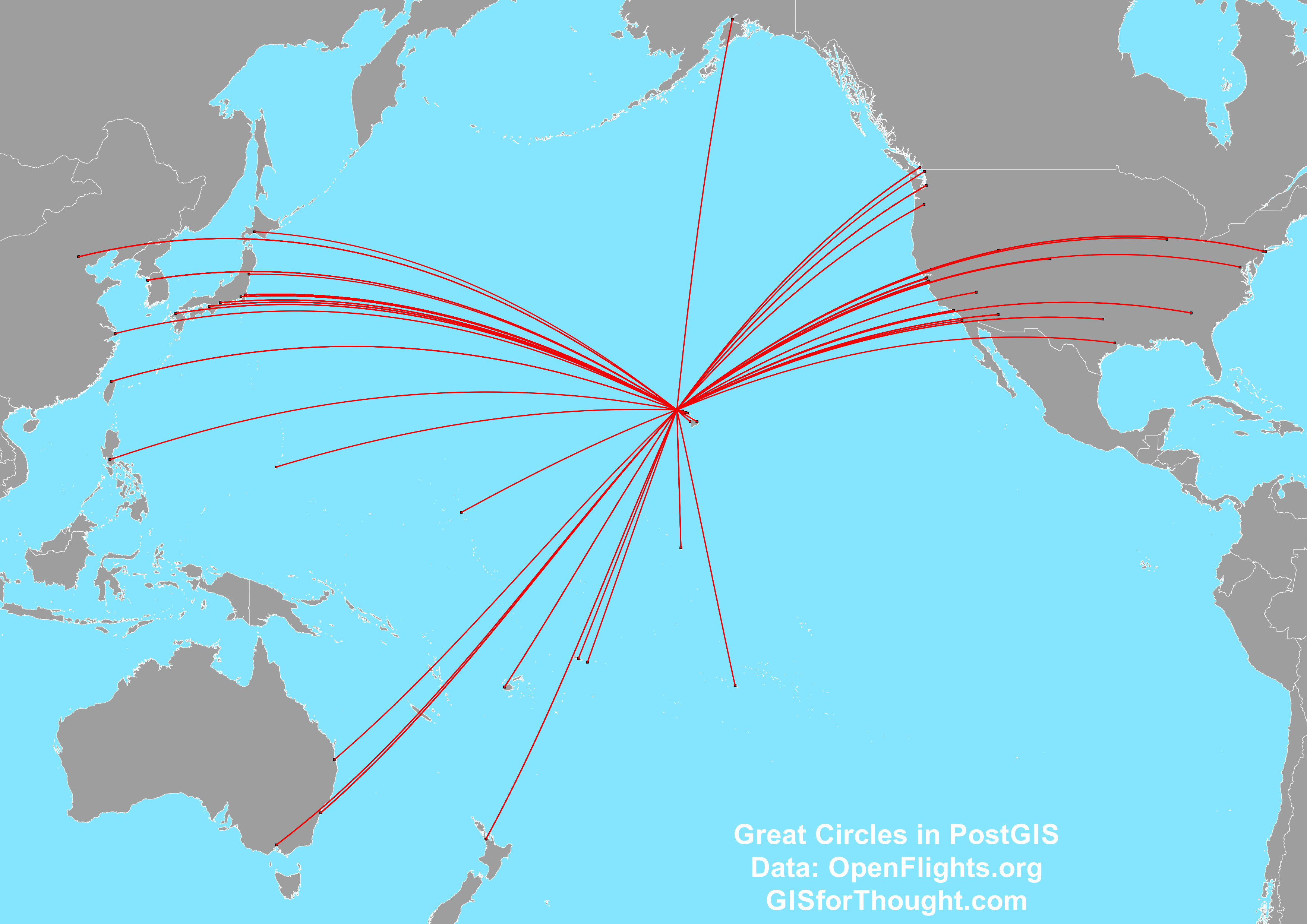
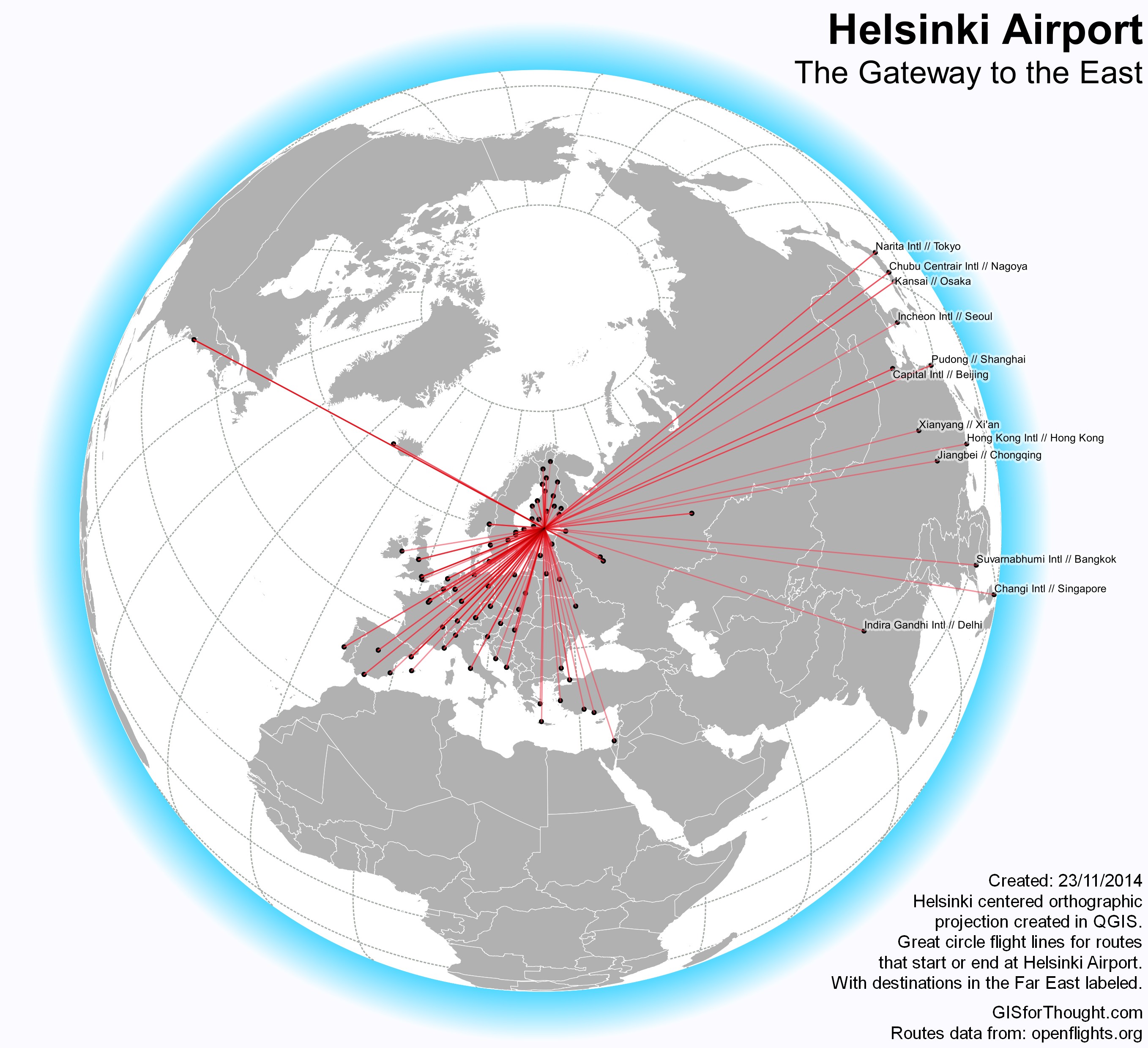
Great Circle Flight Lines
Generating great circle flight lines using PostgreSQL and PostGIS. Uses casting to geography to achieve the shortest geodesic route between any two points on the globe.
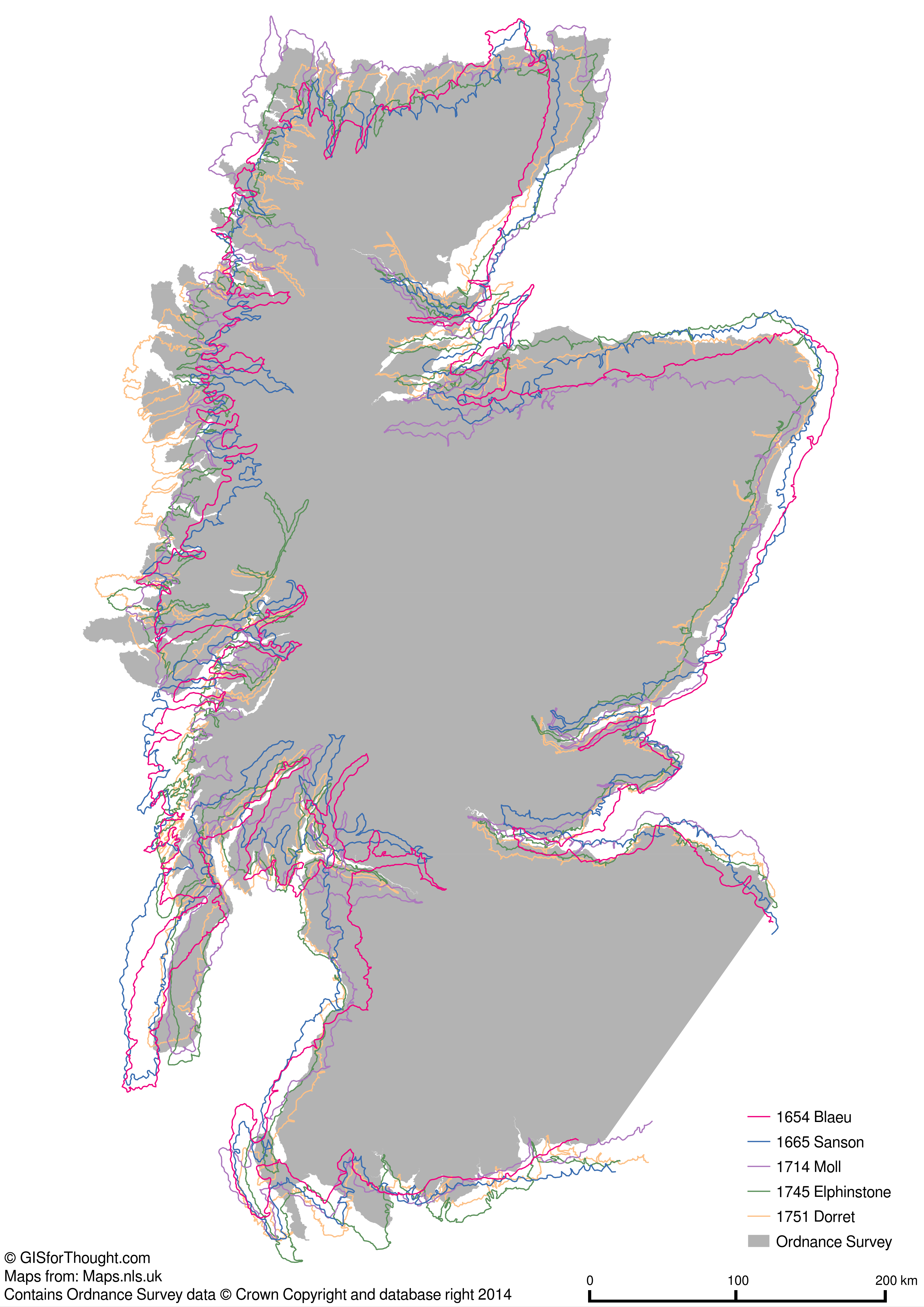
Historic Outlines of Scotland
Mapping the historic outlines of Scotland between 1600-1700. Included georeferencing vector data using ogr2ogr.