Jiankou to Mutianyu from the south avoiding “the ladder”.
This was originally posted on Great Wall Forum in 2014, which has no longer available: The Great Wall of China
This hike also took place in 2014. And is an account of hiking from Jiankou to Mutianyu along the Great Wall of China.
It was an early start for us on the 26/05/2014. We were down for breakfast at 7:30, and on our way to Dongzhimen soon after. We had every intention of taking the bus to Huairou and a taxi onwards from there.
Finding the bus station was not a problem.
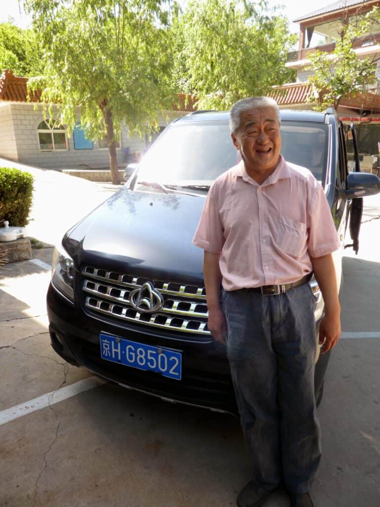
We were going to take bus 916, but on the day there was a queue of about 3 busses worth of people in front of us. This would have been ok if the busses had been regular, but while waiting for about 20 minutes we did not see a single one. Even the Chinese commuters in the queue were getting frustrated. At this point we were approached by a lady, who offered her husband as a chauffeur. That is how we met mr. Zhang! (exclamation point is part of the name). The lady drew a rough map on a piece of paper, which indicated that her husband would drive us from Beijing, to Jiankou, drive himself to Mutianyu, wait for us there, then drive us back to Beijing. We would pay him when we were safely back in Beijing. The price was 600 Yuan, plus 35 for tolls (was actually 30). Had we been more savvy hagglers this price would probably have gone down, but for three hours of driving and over five hours of waiting, it felt like a fair price for me, especially considering the bus situation.
So we were off.
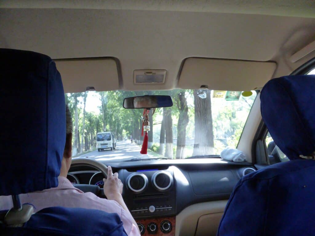
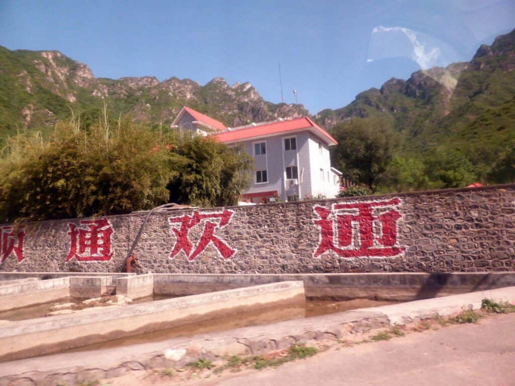
The ride itself was pretty exciting, I am not sure if mr. Zhang! would still have a licence in the UK, but he got us there in record time. In no time we were at the fish farm:
We were originally planning on walking just from Zhengbeilou, as the path from Jiankou to Zhengbeilou had been described as pretty intense, but when we got to the trout farm mr. Zhang! was pretty adamant that we could make it all the way from Jiankou. So up to Jiankou we set off.
mr. Zhang!:
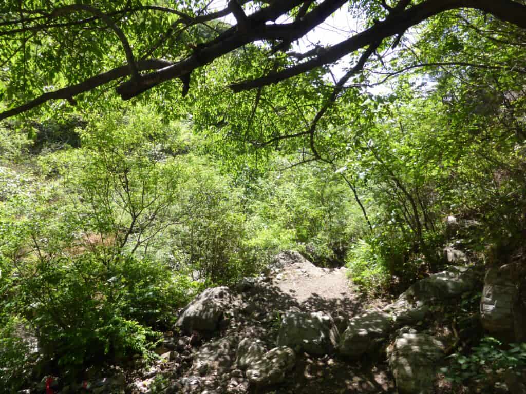
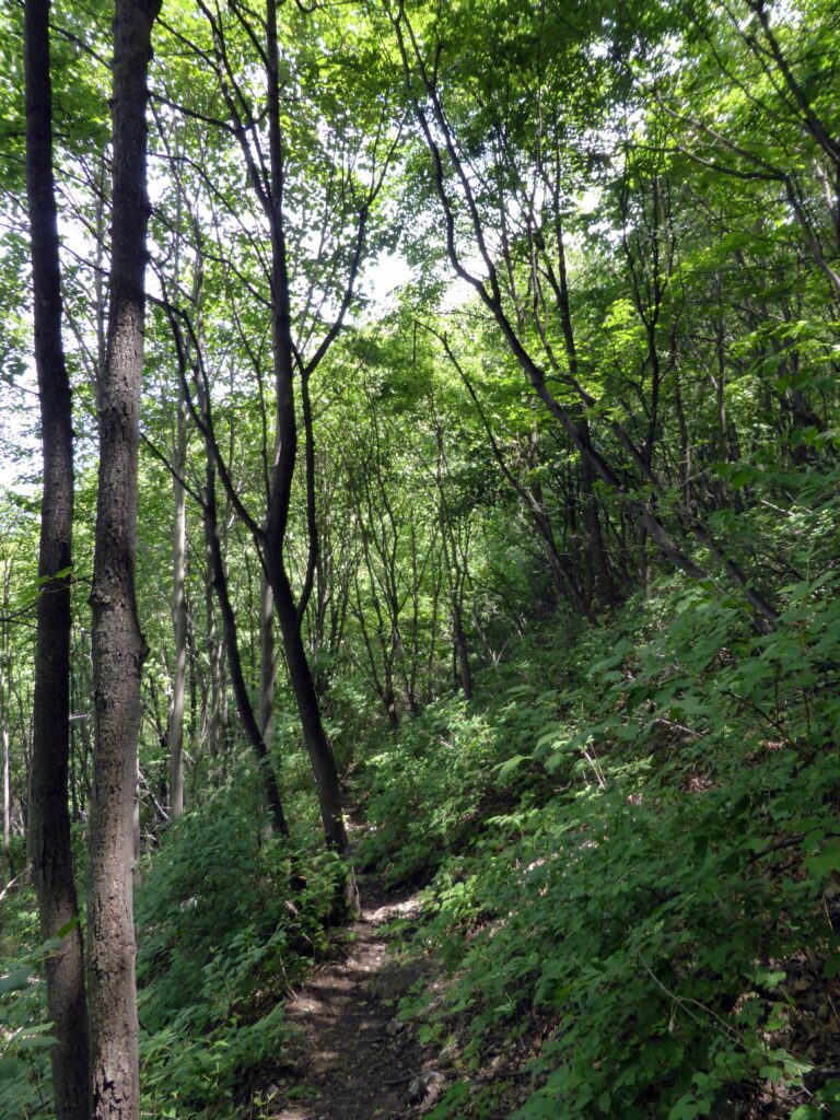
The walk up was pretty steep, but the path was ok.
Jiankou is the pass (lowest point in the wall)
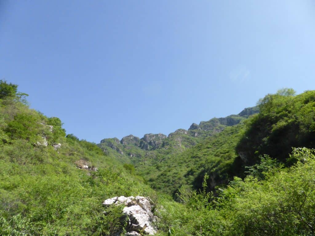
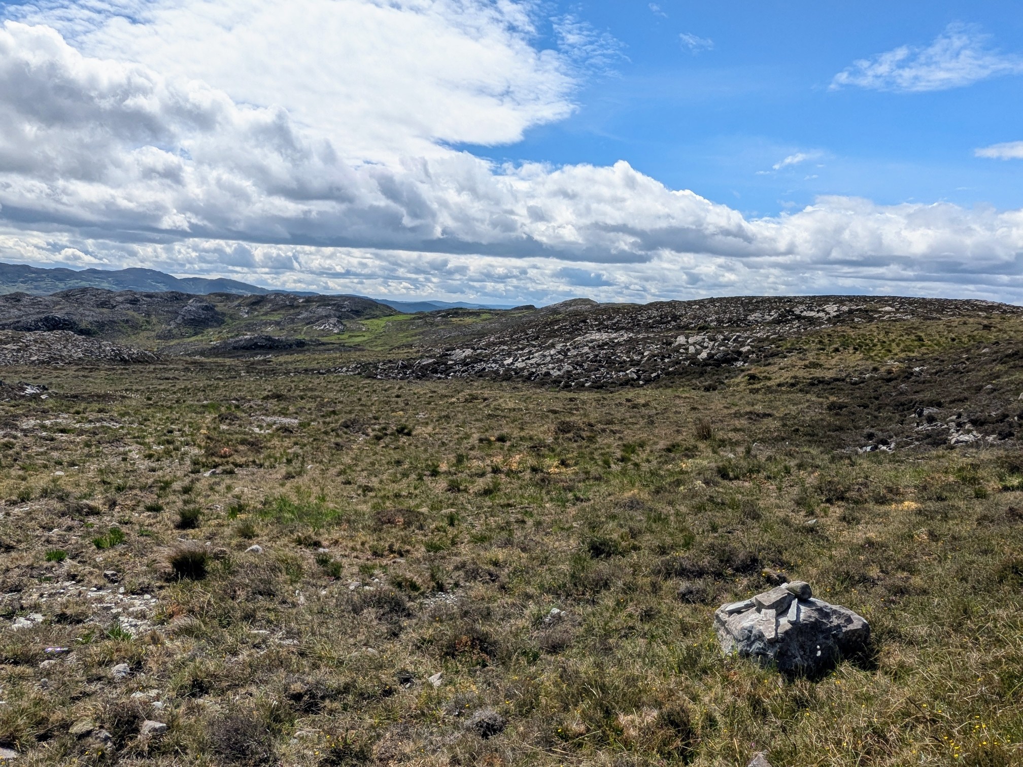
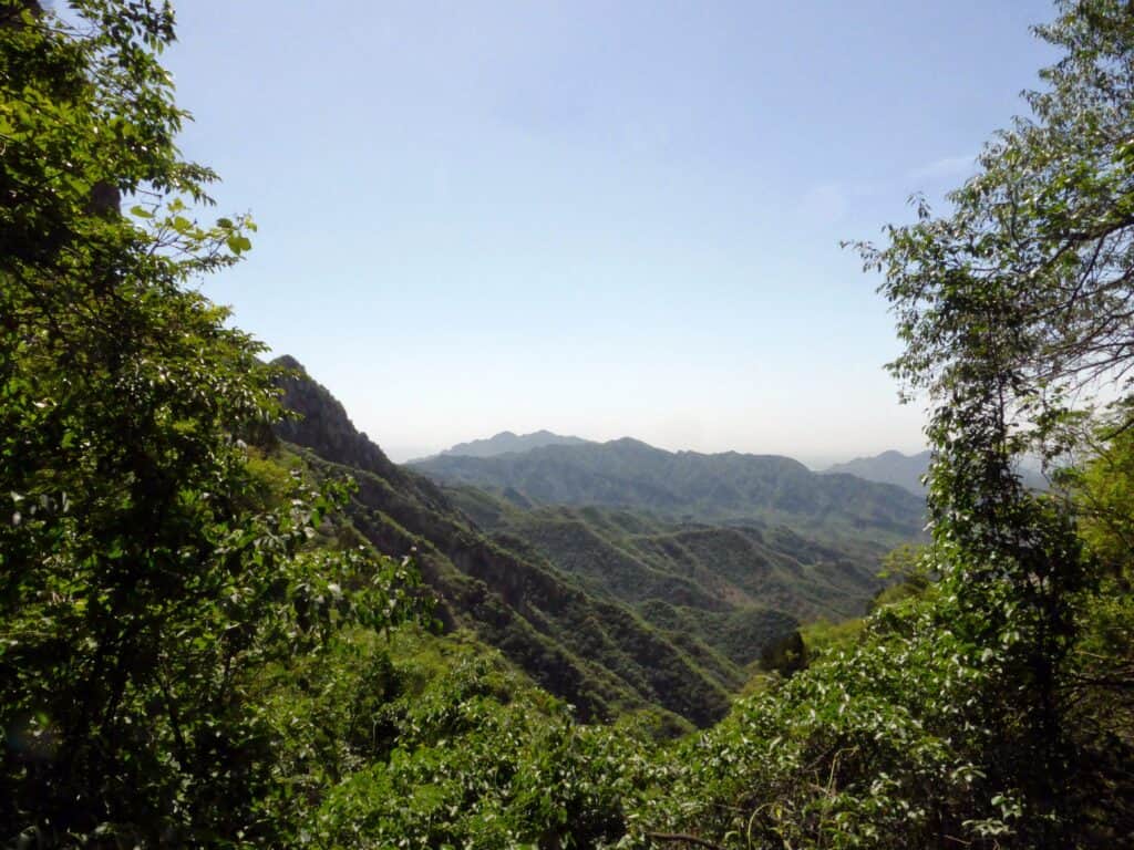
The views made the walk worthwhile:
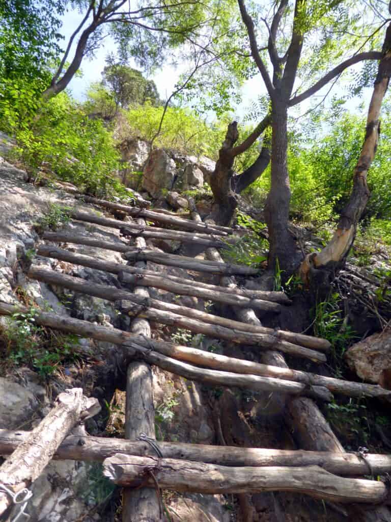
After probably an hour of hiking we made it up to a ladder, after climbing this ladder we were charged 5 yuan each for using it. The ladder later on in the day had a sign about payment, which felt more fair, but 5 yuan wasn’t going to break our budget and the lady was nice enough.
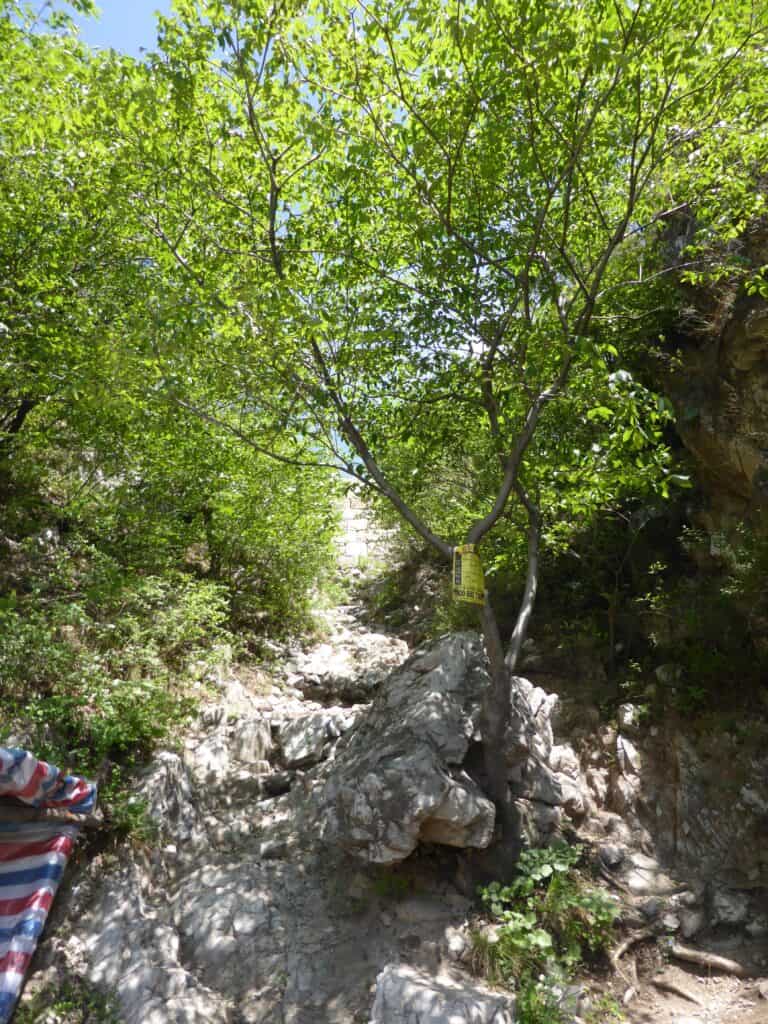
A short final scramble.
We were at the wall, there we saw a group of Chinese heading up the other way (away from Mutianyu). Those would be the last people we was for a while.
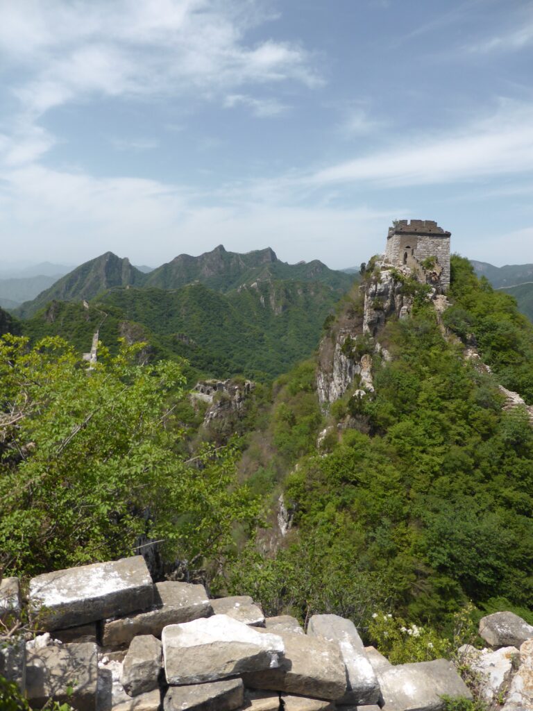
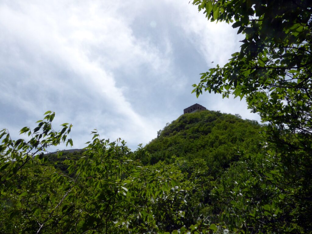
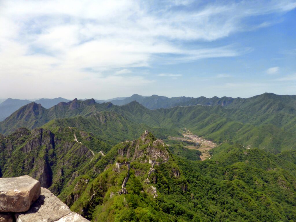
A whole wall to ourselves, exciting and somewhat intimidating at the same time (view towards Mutianyu, with the large tower being Zhengbeilou).
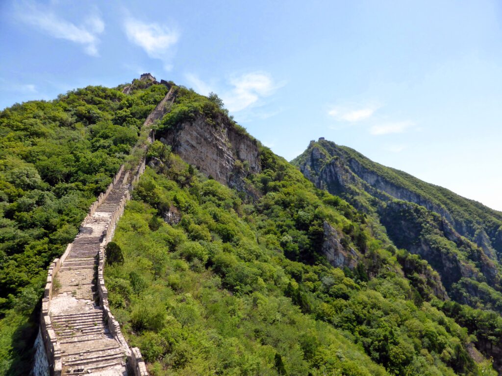
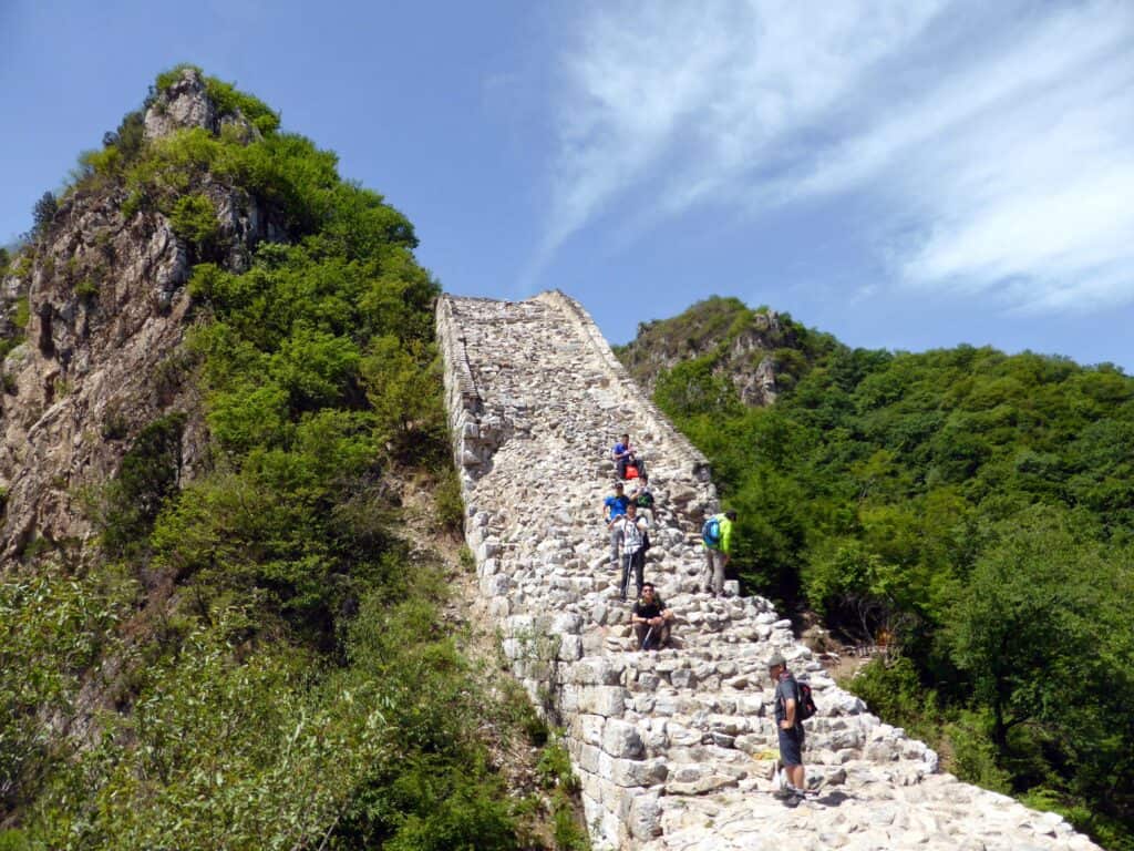
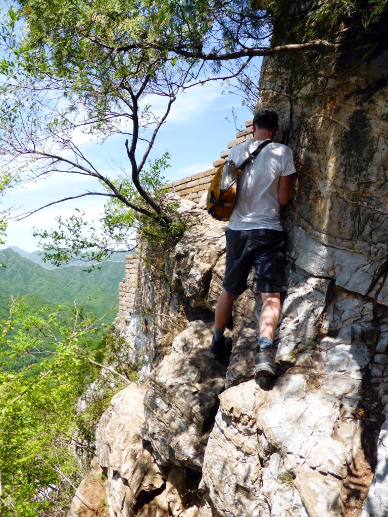
The walk was harder than I imagined it would be, great kudos to user Robtrek who did it in wintery conditions. From a UK point of view a lot of the sections would be classified as scrambling. The were not difficult per se, I was able to complete it, but they were daunting. One false step (or a hold falling off, there were plenty of loose bricks) and you could be dead or injured a long way away from any help. Read Robtrek’s post about the tricky parts, which was really helpful.
So don’t take this post as encouragement or discouragement. I felt it was difficult; my flatmates who are rock climbers would have found it easy, but look at the pictures posted and make your own educated choice. I would also recommend hiking boots. I don’t think I would have been able to make it the other way around, from Zhengbeilou to Jiankou. Many of the sections we passed were definitely easier going up than they would have been going down. It was however the highlight of my trip, and overall a great experience.
A less mentioned aspect is that the walk is long. We were walking for over 5 hours, with a lot of up hill (our route more so than some, as we came down to skip the ladder section). We had about 5 liters of water with us, and we used it all. It was also a scorching day, ranging between 30-35 degrees celsius. My walking companion was really struggling towards the end, so a good level of fitness is recommended.
Apologies for the lecture, back to the interesting parts.
First tricky part.
Second tricky part:
You come off the wall at this point:
And back onto the wall:
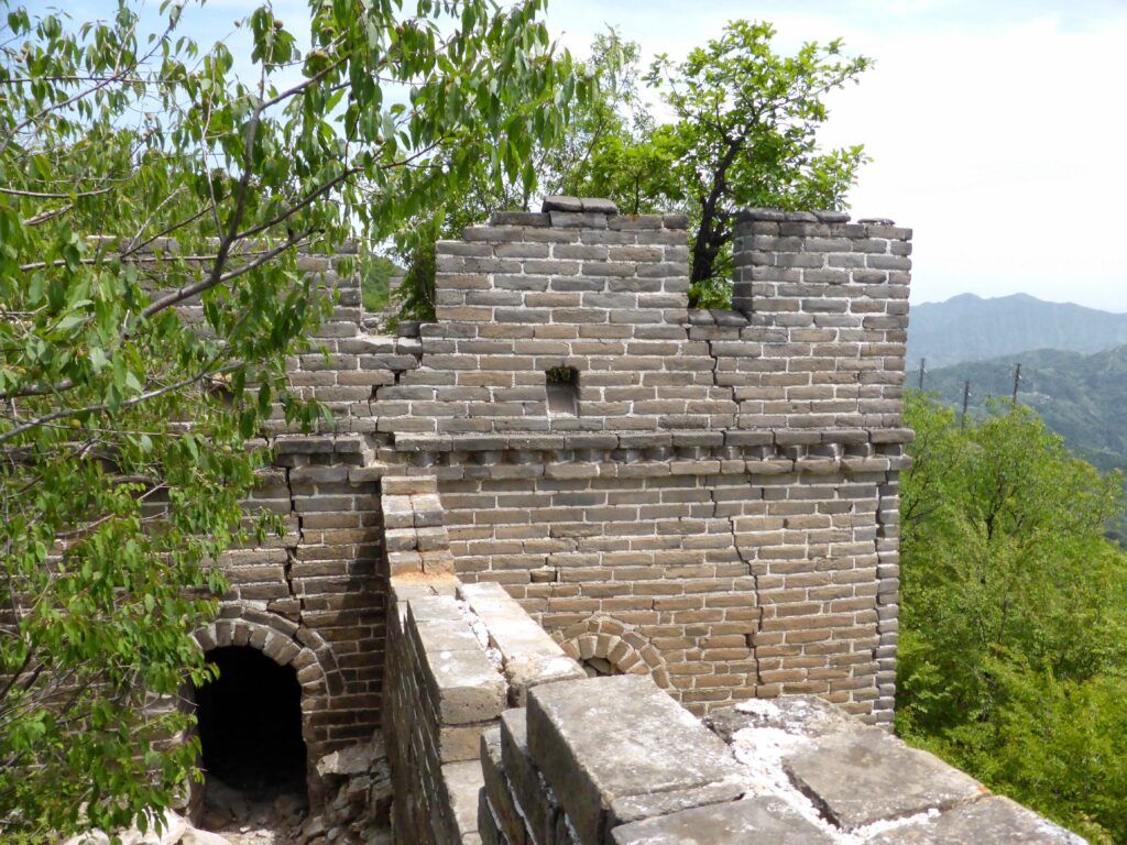
They don’t call it the wild wall for nothing:
A squeeze:
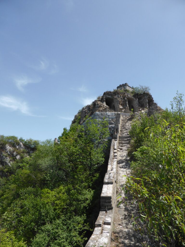
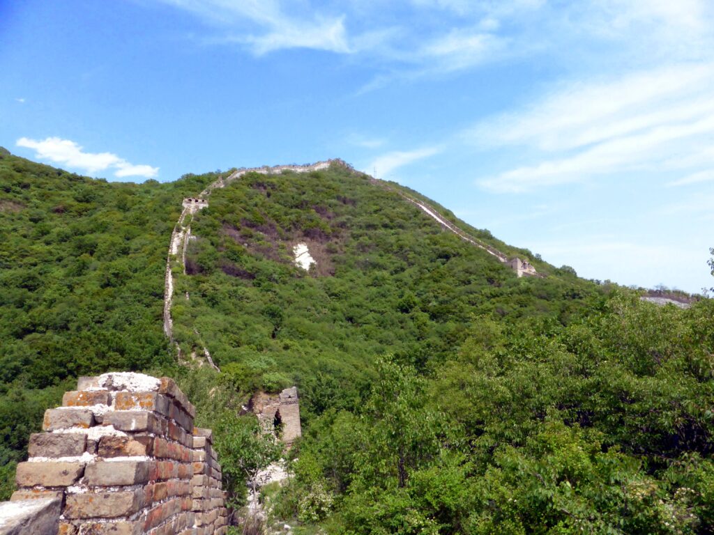
Zhengbeilou in sight:
Not long after the section seen in the picture above we decided to venture off of the wall towards the north. There was a clear path that others had used, and this eventually met up with a large path going upwards. This was the path from the northern side to Zhengbeilou. We did this to avoid “the ladder”, so we didn’t see what state it was in.
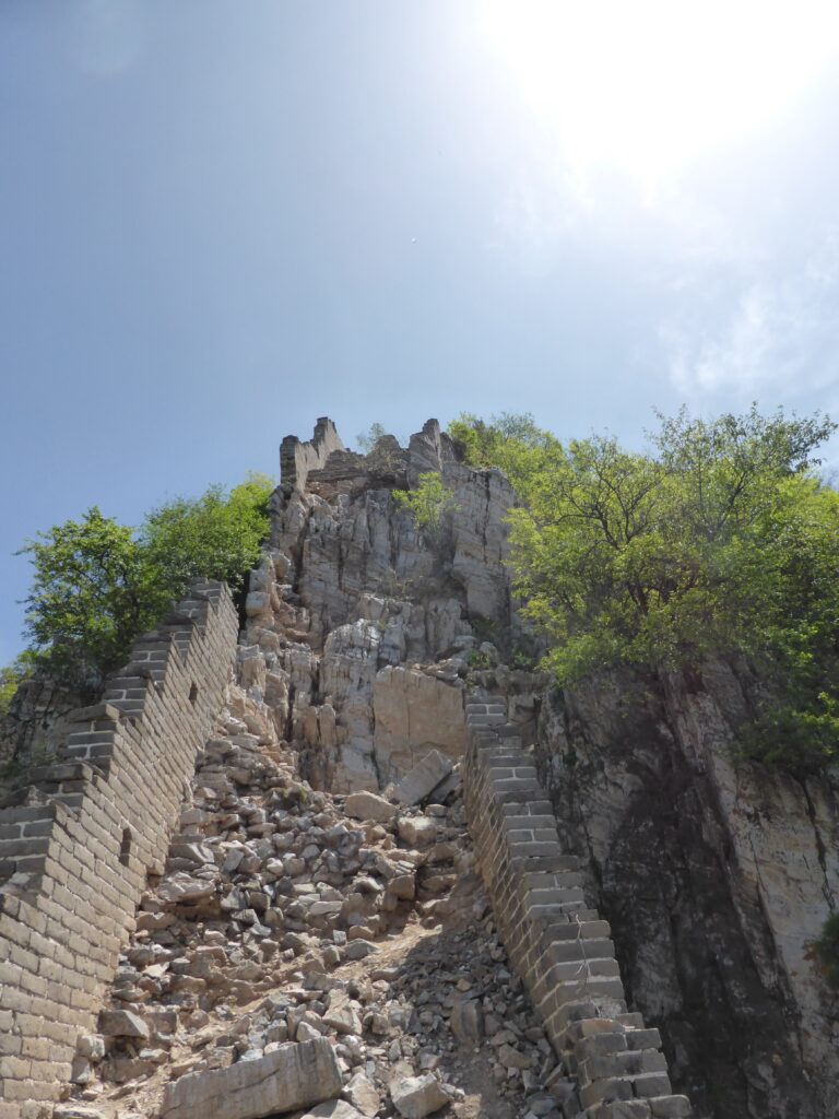
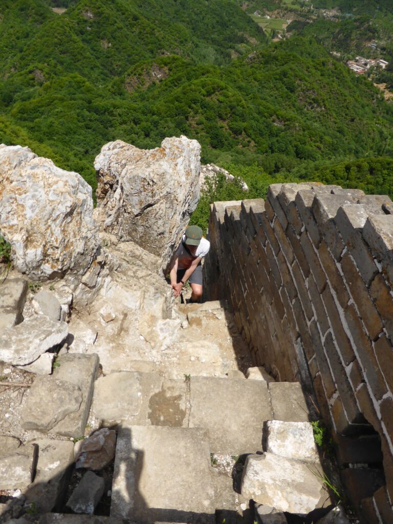
Path down:
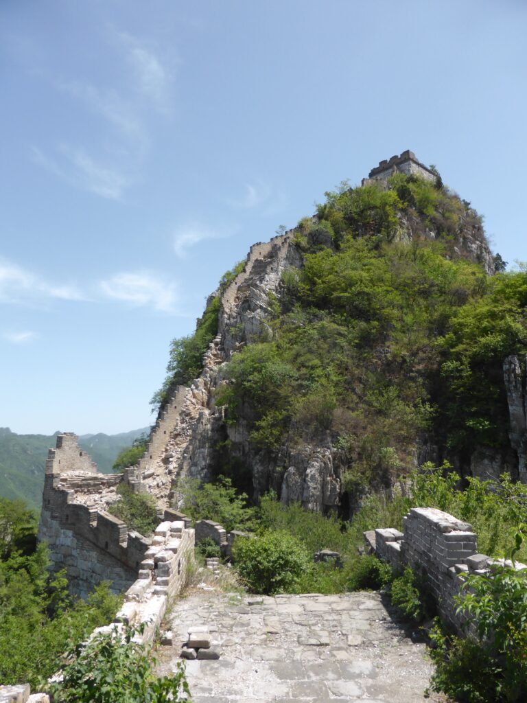
Zhengbeilou from the path coming up, so we descended a decent distance:
So if you are worried about “the ladder” it can be bypassed.
Ladder up to Zhengbeilou from the north with a 5 Yuan charge sign:
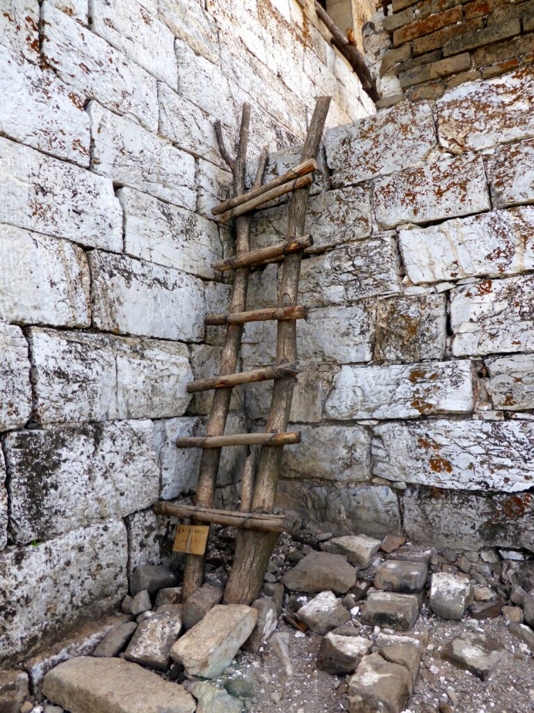
The guy manning the ladder at Zhengbeilou had an enviable office:
He was also selling ice cold beers for 10 Yuan, a price we could not pass up on.
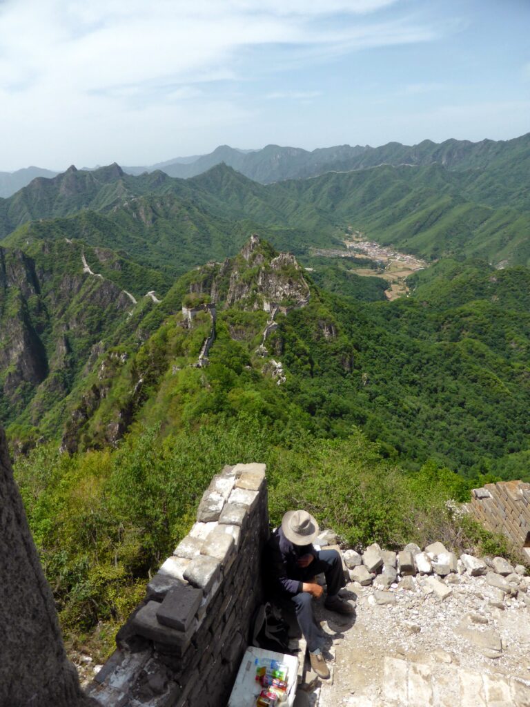
Views back towards Jiankou:
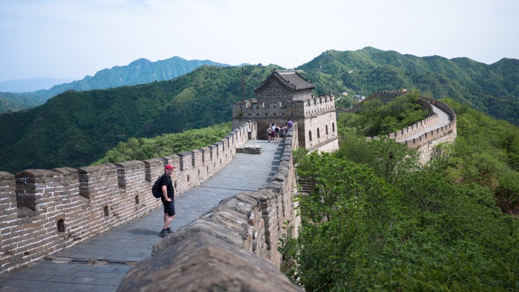
The walk to Mutianyu on the other hand was easy, but longer than expected. We even skipped the birds nest, due to the climb up.
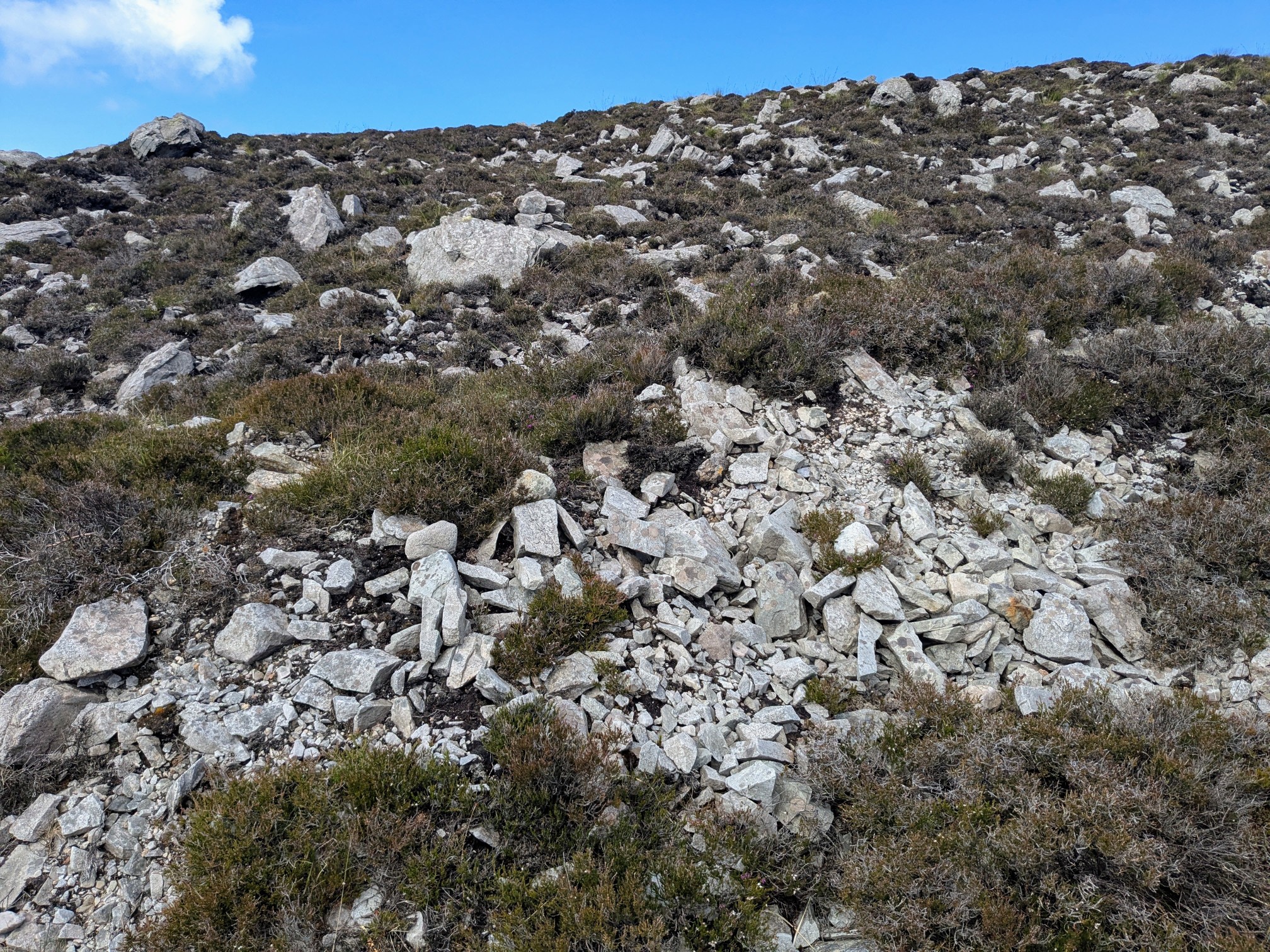
The wild taking over the wall:
Climb to the birds nest, we used a bypass:
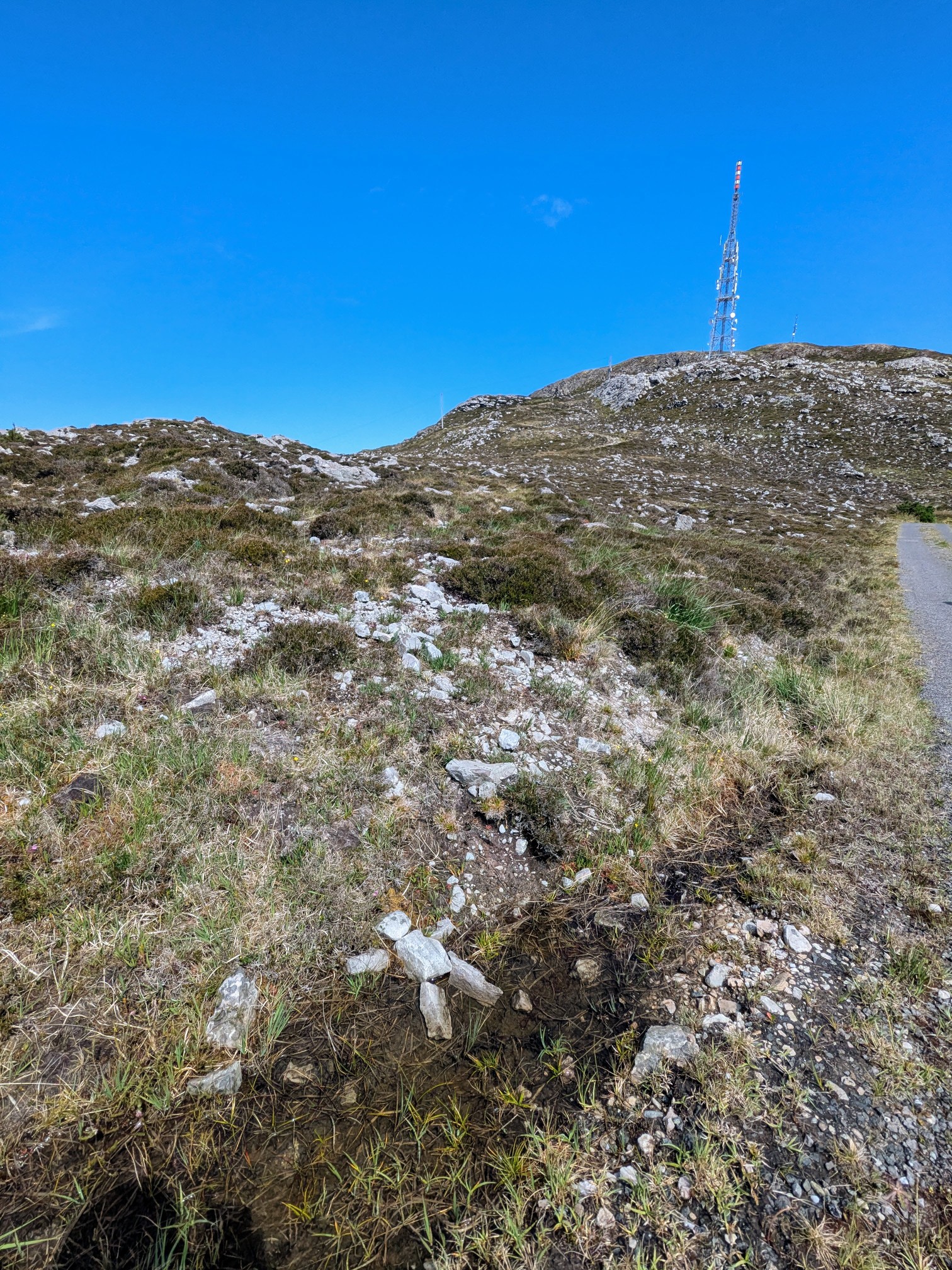
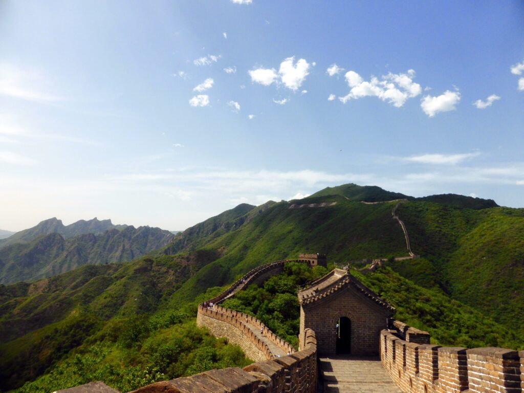
Touristy section achieved, but even then still quite a walk ahead:
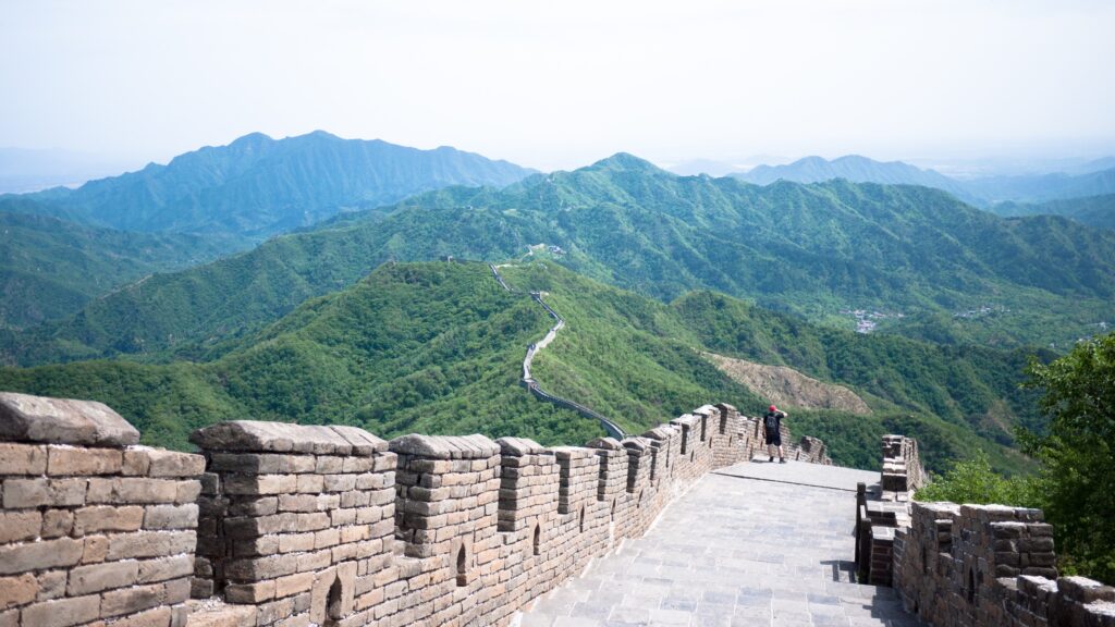
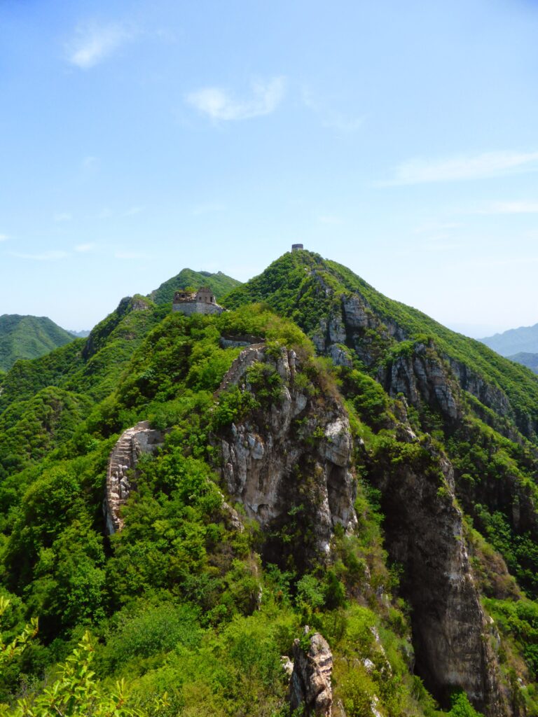
The Touristy section proved to be not so touristy at least at first, good view of the days walk with Jiankou being the low point in the ridge just left of the centre:
Modern part near Mutianyu:
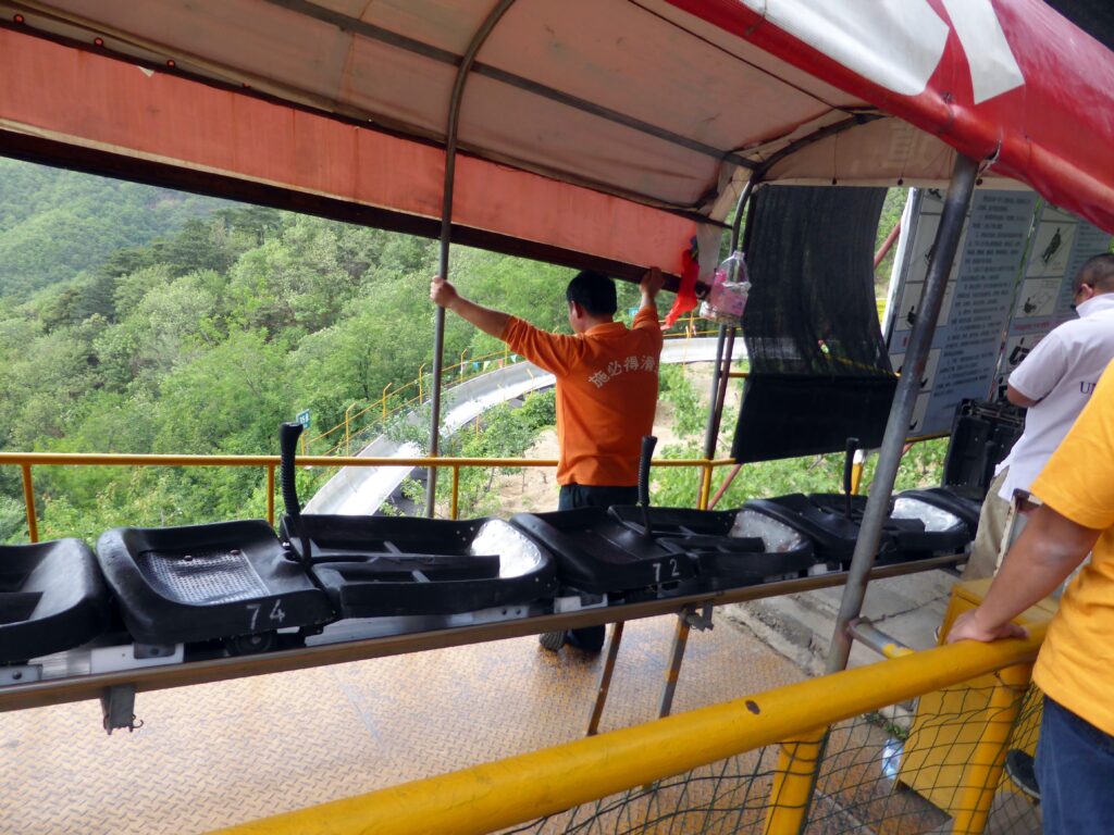
And there was only one way to get back down, toboggan! (the price of which was now up to 60 Yuan) :
Map of the walk from Jiankou to Mutianyu: