Skip to content

GISforThought

GIS and Mapping Blog from Ireland

  • Home
  • About Me
  • Post Archive
  • Portfolio
GISforThought

QGIS Inverse Shapeburst Fills

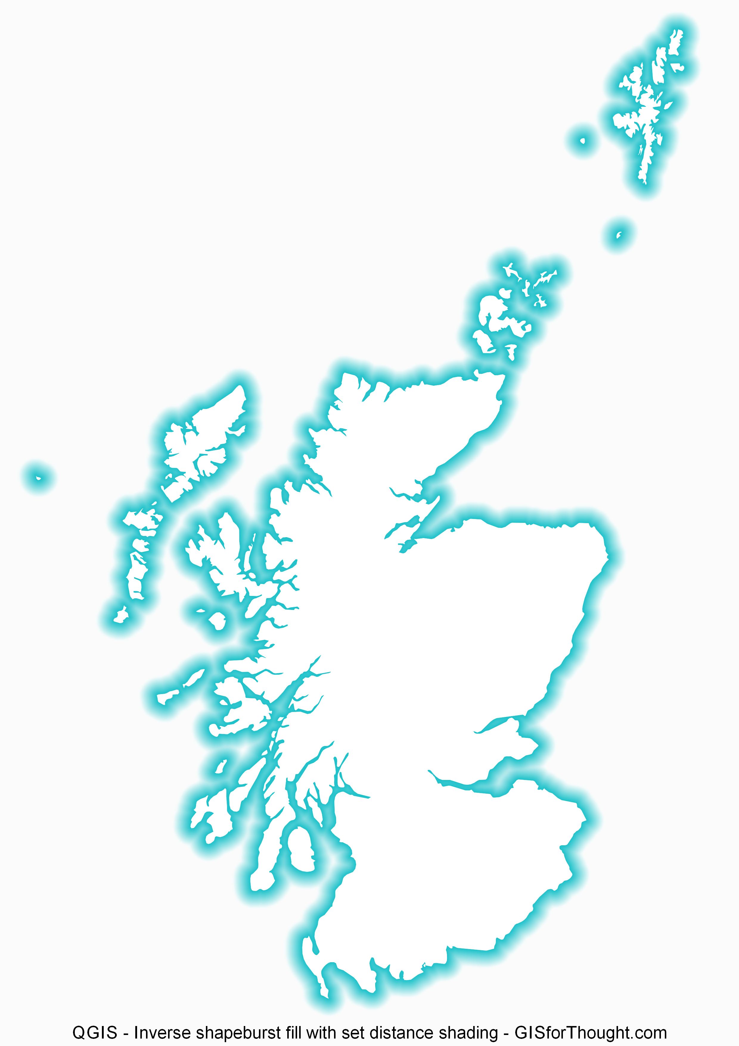
Starting with QGIS 2.4 we have seen the introduction of both shapeburst fills and inverse fills. This allows for some great visualizations.
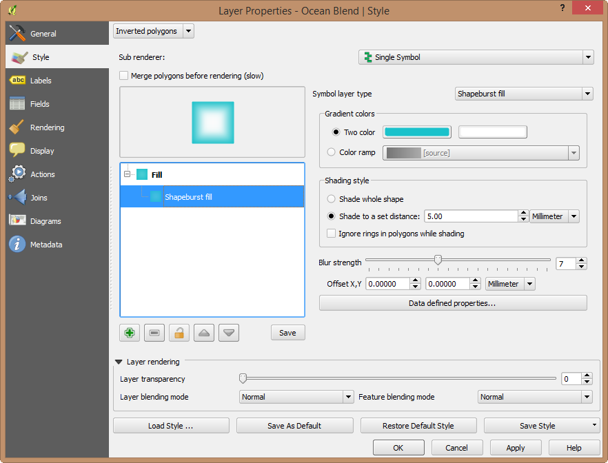
QGIS Inverse Shapeburst Fill

Options:
Inverse Shapeburst Fill Settings

QGIS Layer Style File (save it as a “.qml” file and load a style):


  0

  0

  0


  0

  generatedlayout


Author Heikki VesantoPosted on November 5, 2014July 27, 2022Categories All, Mapvember, OSGEO, QGIS

Post navigation

Previous Previous post: Trans Siberian Leaflet
Next Next post: Glasgow Subcrawl Map

Post Archive

Latest Posts

  • Storm Éowyn ImpactFebruary 7, 2025
  • My Strava Activities from the Same Place at the Same Time AnimatedSeptember 20, 2022
  • Luas Map Compared to Real GeographyAugust 22, 2022
  • Scotland’s Cartographic OutlineAugust 9, 2022
  • Made With OpenStreetMapAugust 8, 2022
  • Featured PostsJuly 21, 2022
  • Commuting in Ireland MappedJanuary 19, 2022
  • Dublin Neighborhoods MappedJanuary 15, 2022
  • 30 Day Map Challenge 2021November 30, 2021
  • 30 Day Map Challenge 2019February 24, 2020

Featured Posts

  • Storm Éowyn ImpactFebruary 7, 2025
  • Luas Map Compared to Real GeographyAugust 22, 2022
  • Dublin Neighborhoods MappedJanuary 15, 2022
  • 30 Day Map Challenge 2021November 30, 2021
  • 30 Day Map Challenge 2019February 24, 2020
  • Every Person in Great Britain MappedMarch 5, 2019
  • Storm Harvey QGIS Geometry GeneratorSeptember 6, 2017
  • Schiehallion – Contour lines and Maskelyne’s observatoryJune 2, 2015

Categories

  • 30 Day Map Challenge (2)
  • All (96)
  • Animations (12)
  • Featured (8)
  • Finland (3)
  • Ireland (14)
  • Maps (18)
  • Mapvember (30)
  • OpenStreetMap (6)
  • OSGEO (50)
    • Leaflet (4)
    • PostGIS (15)
    • QGIS (39)
  • Scotland (33)
  • Travel (6)
  • Tutorials (12)

Popular Posts

  • Home
  • About Me
  • Post Archive
  • Portfolio
GISforThought Proudly powered by WordPress