Made using the excellent QGIS2Three.js plugin.
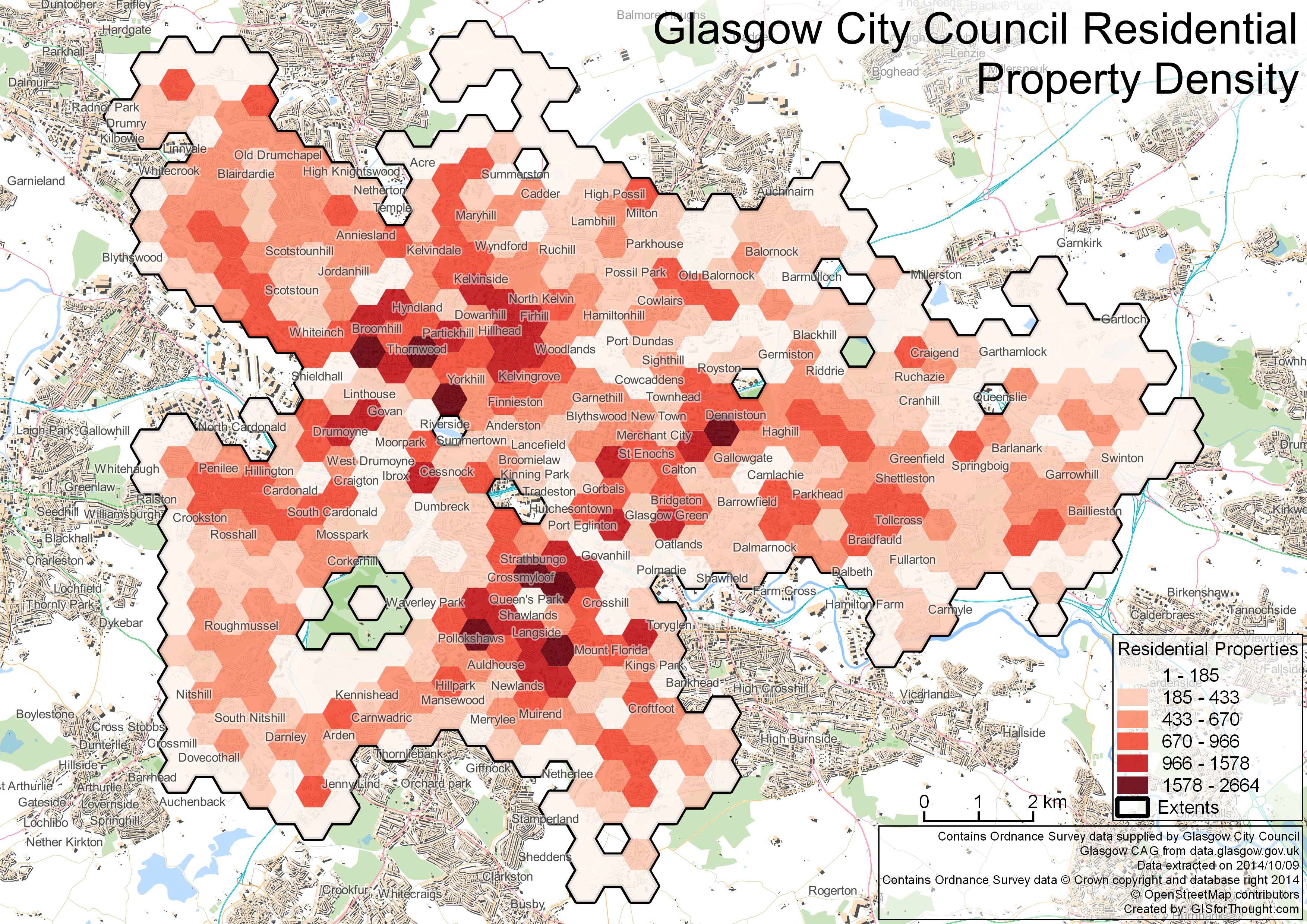
Legend actually refers to property count rather than density.
For more information see Anita Graser’s post: http://anitagraser.com/2014/03/15/3d-viz-with-qgis-three-js/
GIS and Mapping Blog from Ireland

Made using the excellent QGIS2Three.js plugin.
Legend actually refers to property count rather than density.
For more information see Anita Graser’s post: http://anitagraser.com/2014/03/15/3d-viz-with-qgis-three-js/
Number of residentially classified properties.