So we have seen from the previous comparing the raw polygon accuracy between Voronoi generated polygons and NRS generated postcode polygons: Results.
The physical results are interesting, and a visual examination can provide a useful overall comparison, but how does this actually impact me?
I have a CAG from GCC and I just want to attach a postcode to it. How different will my results be between a true postcode boundary dataset from the NRS, and a generated Voronoi dataset from the OS?
I’m glad you are still with me, it might be useful to explain how postcodes actually work in this context:
Lets take a postcode of G31 2XT how does it break down?
Area: G
District: G31
Sector: G31 2
Unit: G31 2XT
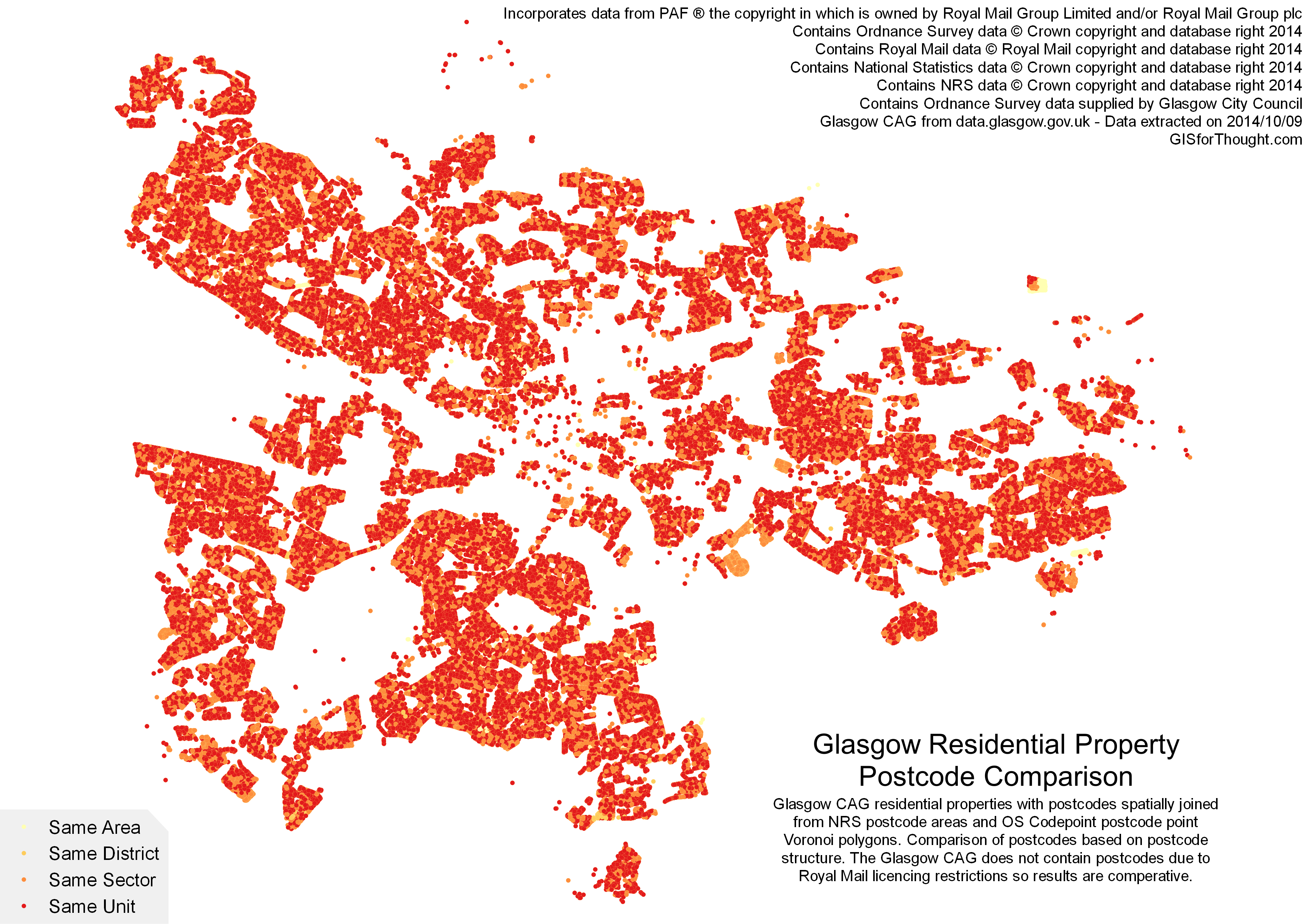
So then we can compare how an actual address dataset, like the Glasgow CAG, spatially joined to two postcode datasets compare:
Assuming the NRS dataset is correct (a good assumption) how accurate is a postcode based on an OS Code-Point Open generated Voronoi polygon based on Glasgow City Council residentially classified properties as of 16/11/2014:
Total number of properties:
245096 100%
Correct Area:
245096 100%
Correct District
243650 99.4%
Correct Sector
240956 98.3%
Correct Unit
174344 71.1%
We can see that up to a sector level a Voronoi polygon can produce an extremely accurate results. A visual comparison of how this plays out in Glasgow can be seen here, with the legend best read from the bottom: